HOME > OUR SERVICES > AERIAL / DRONE MAPPING

FALCON SURVEY

Aerial / Drone Mapping Solutions

Falcon Surveys are one of the earliest adopters of 3D Laser Scanning technology in U.A.E. and our continued investment in Leica Laser Scanners has ensured our survey teams can deliver comprehensive data with speed and accuracy whilst working safely throughout the U.A.E and abroad.

Drone Mapping

WORK SMART WITH DRONE DATA
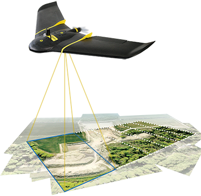
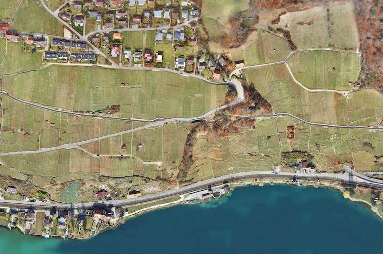
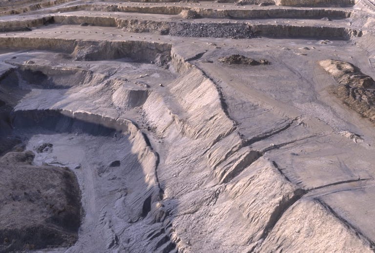
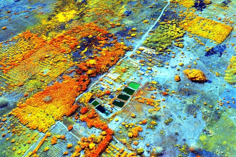
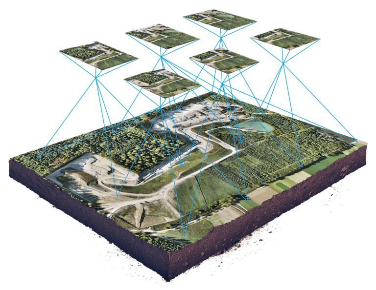
MAP WITHOUT LIMITS

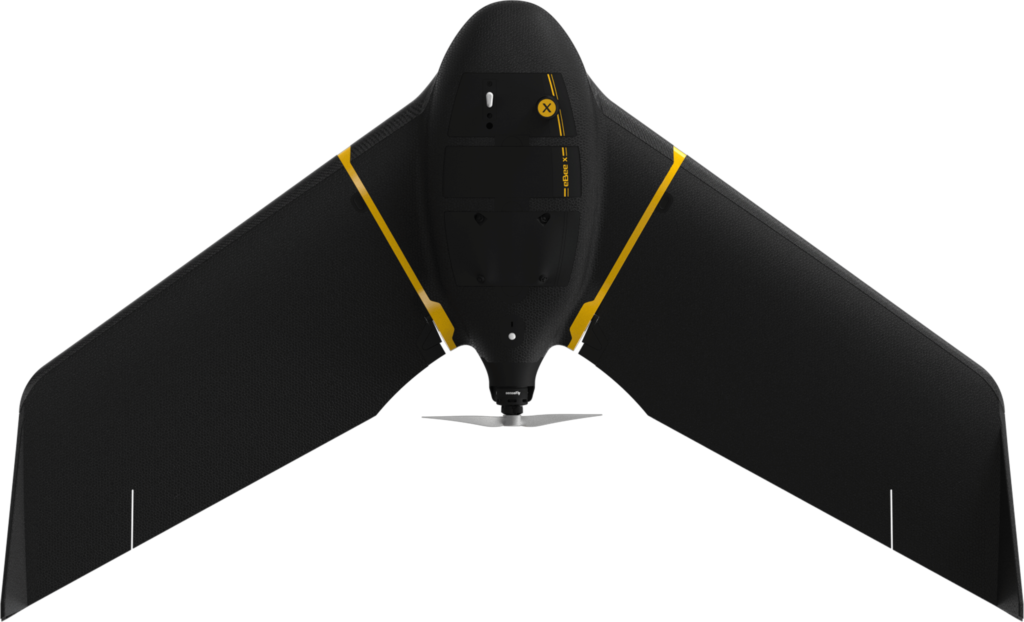
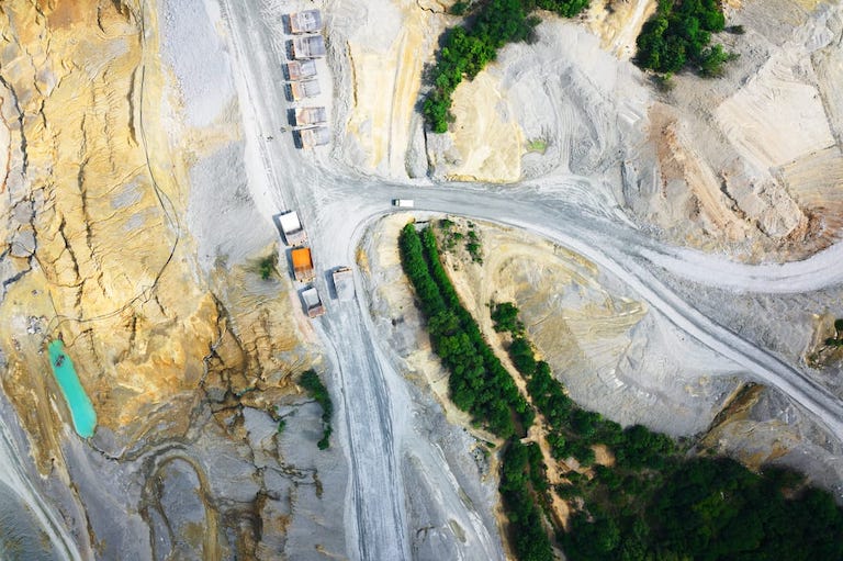
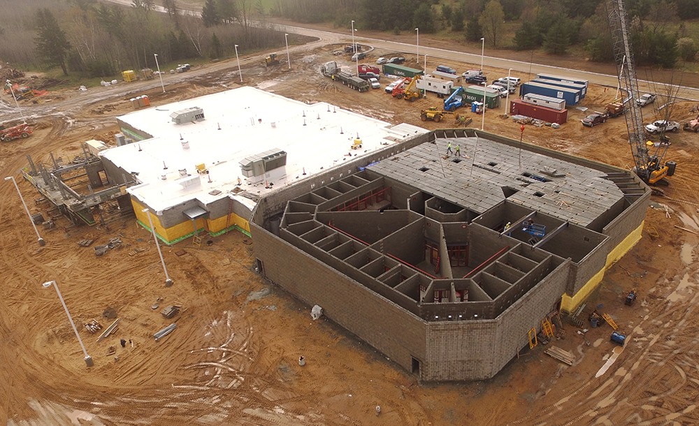
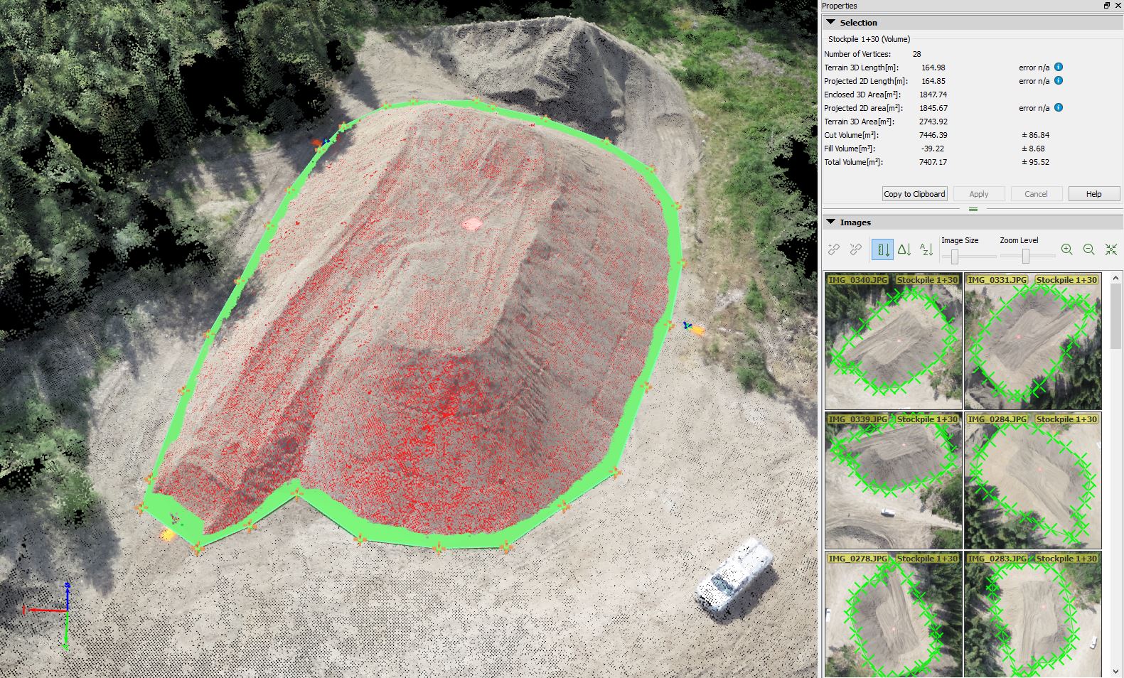
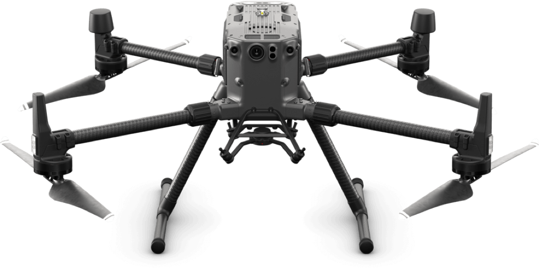
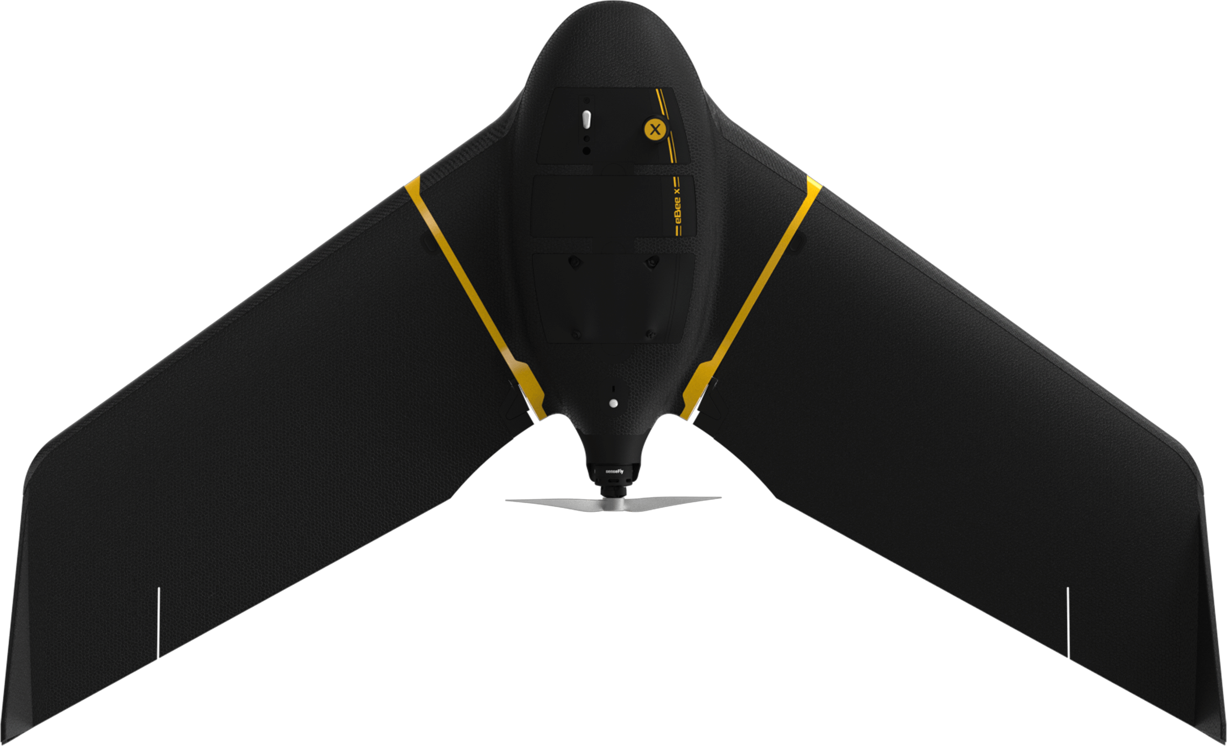
Aerial Vehicles (UAVs) By Martix 300 Drones and Ebee X Drone can improve the efficiency and effectiveness of your projects. By allowing easier access and capturing volumes of highly accurate data in less time, UAVs can reduce project costs. By allowing close-up inspection of hard-to-reach structures, rugged terrain, and remote sites, they can reduce risk. And by providing real-time project information and accurate side by side comparisons, they can facilitate informed decision making, improving project quality.

aerial mapping company

Exploring the SenseFly eBee X with Drone Inspections

We are capable of serving the government and private sector in land surveying, aerial surveying for land management & development, land slope monitoring, stockpile volumetric measurements, designing smart cities, drone mapping projects and many more.

Falcon Survey Engineering prioritizes quality and perpetually continues to achieve highly effective inspections and accurate measurement of aerial drone mapping with centimeter level accuracy at any given time. We have more than 15 years of skilled licensed pilot with High-end surveying drone’s technology. Our clients obtain the deliverables faster, hence promoting drone survey company more agile decision-making with the exact conceptual project requirements. Our drone survey company specializing in aerial inspections and data collection for various industries. Utilizing cutting-edge technology for efficient, cost-effective solutions.

Below is our deliverable points:-

Benefits of Ariel Mapping and Drone Mapping Services from Ariel Survey:-

Aerial Mapping and Drone Survey Sensors

In order to bring about an aerial mapping survey company, a drone sensor needs to be fixed to the interior or the exterior of the airborne platform with line-of-sight to the tightly with some rod equipment’s. It is remotely control sensing with manned aircraft, this is accomplished either through an aperture in the skin of the aircraft or mounted externally on a wing strut with unmanned any aerial mapping vehicles (UAVs), the sensor is typically mounted under or inside.

Hydrographic Services and Hydrographic Survey Services:-

Falcon Survey Services offers Hydrography services where we can provides the basis inspections for all activities which involve during the inspection under the sea water. Hydrographic survey works to ensure that all the world's seas, oceans and navigable waters are surveyed and charted, thereby we supporting safety of navigation and the protection of the marine environment.

It coordinates the activities of national hydrographic determinations and sets standards in order to promote uniformity in supports with charts and hydrographic documents services work. We focus on the issues of survey hydrographic works which has the best practices and provides guidelines to maximize the use of hydrographic data information during the survey.

We have following the guideline before starts working on Hydrographic survey Services.

During the multi beam sonar measures the depth of the sea floor by analyzing the time and ranges. It creates sound with waves during travel from a boat to the sea floor. It provides amazing detail of the sea floor, especially in rocky and rough terrain, where it gives a complete picture of the bottom of the sea. Multi beam sonar is very curtail and useful in the specific areas such as the Arabian Country, Gulf Country, Middle East, African and UK, USA where the sea floor is composite and more often with thousands of rocks. However, in relatively shallow, flat areas like those found along the mid-Atlantic coast, the multi beam may not be very valuable so, we surveyors use another tool called side scan sonar.

The sonar creates an image of the sea floor, but does not determine and calculate the depths of the sea. If surveyors find a wreck or obstruction using side scan sonar, they will determine and calculate using the least depth with multi beam sonar technology.

Determining Positions:-

The most essential ingredients to charting for accurate positioning and tides or water levels. Until the 1970s, hydrographic are determined positions of water depths by using a sextant. Nowadays modern Global Positioning System provides accuracy and efficiencies never dreamed of only a few years ago. Information gained by calculating and predicting the rise and fall of tides, and accurate positioning, is critical to mariners as they guide large ships in and out of our sea ports.

In many cases, ships are less than three feet off the bottom and within inches of clearance below a highway bridge. Now a day’s technology gives pilots and mariners the knowledge to maneuver along gulf area coastline area and into our ports and harbors locations.

Data Processing:-

Once upon a time, hydrographic data has been collected using sonar. We referenced to the exact location at which it was collected. The raw sounds are manual adjusted to a standard or absolute water level (datum) using predictions (and subsequent final observed tides) from tidal observations collected at water-level stations.

Horizontal positions (latitude and longitude) are recorded using different equipment and need no further adjustment. Information about the coastline is calculated effective result to the recent coastal survey area & maps to identify new features and modifications. Eventually, the sound of recorded data are re-processed to produce the final outcome soundings.

Other Support Service / Applications:-

In addition to produce the data which is needed to update for nautical charts, hydrographic surveyors support a variety of activities such as port and harbor maintenance (dredging), coastal engineering (beach erosion), coastal zone management and offshore resource development. For all the depth information and seafloor characterization is also useful in determining hydrographic surveyors understanding marine geologic processes.

AERIAL / DRONE MAPPING

Who should consider this System:

Drone mapping services and 3D modelling are becoming far more cost effective due to the latest drone camera technology. Our fully licensed and insured drone filming team are able to provide 2D and 3D mapping services to a diverse range of clients in a manner that was previously uneconomical. Today, clients use our Drone Mapping Services to create 3D visualisations, take measurements and perform calculations on volumes of large areas. We provide 2D and 3D mapping which can be integrated into a wide variety for formats including point cloud for use on client’s own software and CAD systems

drone mapping services

GET OUTSTANDING DRONE MAPS

Map outputs With its range of best-in-class cameras, Falcon Survey can produce high-resolution, highly-precise drone map outputs.

Orthomosaic maps

3D reconstruction

Multispectral imagery

Single images

Construction Update Survey

Progress of Construction Works can be provided accurately; Drone mapping can avoid the risks also.

Show More

Mining & Aggregates

Use Aerial Data to save cost and time in a variety of mining processes. Volume of Piles can be provided

Show More

Infrastructure Inspection

Safely and easily capture a high-resolutions Ariel view of the Infrastructure in minutes

Show More

Archaeology

High-resolution maps & 3D digital models are driving new era of archaeological discovery

Show More

Urban Planning & Land Management

Drone DSM into CAD to build virtual Models to define boundaries

Show More

Roofing Inspection

Drone Inspection for finding out any damage for the roofs of skyscraper buildings

Show More

What are the benefits of drones in surveying?

aerial drone mapping
Reduce field time and survey costs

Reduce field time and survey costs

Capturing topographic data with a drone is up to five times faster than with land-based methods and requires less manpower. With PPK geo-tagging, you also save time, as placing numerous GCPs is no longer necessary. You ultimately deliver your survey results faster and at a lower cost.

Map otherwise inaccessible areas

Map otherwise inaccessible areas

An aerial drone mapping services can take off and fly almost anywhere. You are no longer limited by unreachable areas, unsafe steep slopes or harsh terrain unsuitable for traditional measuring tools. You do not need to close down highways or train tracks. In fact, you can capture data during operation without an organizational overhead.

Provide accurate and exhaustive data

Provide accurate and exhaustive data

Total stations only measure individual points. One drone flight produces thousands of measurements, which can be represented in different formats (orthomosaic, point cloud, DTM, DSM, contour lines, etc). Each pixel of the produced map or point of the 3D model contains 3D geo-data.

Frequently Asked Questions

Here are some frequently asked questions about drone mapping. We are sharing this for your quick information.

aerial mapping
Drone mapping, or drone land surveying, refers to the use of UAVs (unmanned aerial vehicles) equipped with a downward facing camera to capture aerial imagery. Photogrammetry software then turns these images into maps, orthomosaics, 3D models, contour lines, point clouds and other virtual representations of the physical world. Drones have become excellent at providing fast, easily repeatable and cost-effective survey maps and insightful data across a variety of industries.
Drone mapping provides an up-to-date and accurate map or 3D model of an area, with complete measurements such as distances and volumes. This enhances decision-making in a number of industries. Also, as drones can fly lower, they can provide maps with higher resolution, lower GSD and better accuracy than manned aircraft or satellites. They are also capable of collecting hundreds or thousands of data points in less time than an operator could do with a terrestrial surveying instrument.

1. Check before you leave the office

Check the local regulations and make sure that you are allowed to fly your drone at the planned location. Also, make sure that the weather is suitable, meaning no rain, fog, snowfall or strong winds. Check that the battery of your drone and connected devices such as tablets are fully charged and that the memory card of your drone camera has sufficient empty space to capture the entire project.

2. Plan your flight

You can create the survey flight plan with the drone flight planning app on the tablet. For this, just tap and drag the points around the area you want to survey, or import a KML file. Make sure you account for tall objects within the flight plan, as well as altitude differences. If needed, you can adjust flight settings such as altitude, ground sampling distance (GSD), flight direction and images overlap.

3. Set up your flight in the field

During this step, you basically unpack and assemble the drone and make sure that it is ready to take-off in safe conditions. Following the interactive check-list, you will one-by-one check every parameter, like the calibration of the airspeed sensor and making sure the camera lid is removed.

4. Fly and collect images

After pushing the take-off button, the drone autonomously takes off, captures images and lands back where it started. In this step, the operator essentially makes sure that nobody approaches the drone during take-off or landing and that the weather conditions stay optimal for the survey mission.

5. Geotag your images

After one or several flights, import the images into WingtraHub software to geotag them s. Geo-tagging assigns geographical position (X, Y, Z) information to the images either in a separate CSV file or in the images’ meta-data.

The performance and type of drone, the quality of its components, the camera resolution, the height at which the drone flies, the vegetation, and the method and technology used to geolocate the aerial images can heavily influence the accuracy of drone survey mapping. At this point, it is possible to reach an absolute accuracy down to 1 cm (0.4 in) and 0.7 cm/px (0.3 in/px) GSD under optimal conditions with a high-end surveying drones.

We deliver fast, accurate and detailed drawings

Are you looking for Survey

Ready to get started? Let's talk.

If you are in need of a residential land survey, commercial land survey or telecommunication land survey, Falcon Survey is the land surveying firm for your project.

About us

Falcon Survey Engineering Consultants is a pioneering Survey Engineering Company in UAE established in the  year of 2007, built on a strong work ethic, honesty and a commitment to relationships. Today Falcon is one of the leading organizations in the field of Land Surveying, Soil Investigation, Ariel Survey (UAV/Drone Mapping), Bathymetric Survey (Hydrographic), Underground Surveying, 3D Laser Scanning Surveying, Calibration Services, Material Testing as well as Geographic Surveys which has International Standard and Quality

Quick Contact

© Copyright 2023 | Falcon Group - All Rights Reserved.

Call Now Button