
- HOME
- ABOUT US
- OUR SERVICES
- LAND SURVEY
- BUILDING SURVEY
- CONSTRUCTION SURVEY SERVICES
- MOBILE MAPPING
- AERIAL / DRONE MAPPING
- UNDERGROUND UTILITY SURVEY
- 3D LASER SCANNING
- METROLOGY SCANNING
- SOIL INVESTIGATION
- BATHYMETRIC SURVEY
- OCEANOGRAPHIC SURVEY
- GEOPHYSICAL SURVEY
- METEOROLOGICAL SURVEY
- MONITORING SOLUTIONS
- DRAINAGE & SEWAGE INSPECTION
- CORING & SCANNING
- OUR TECHNOLOGIES
- CONTACT US
© 2024.
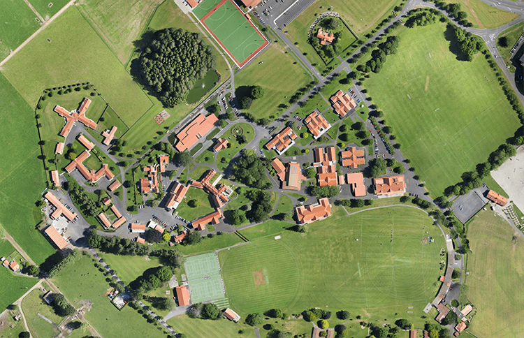
Map outputs
Orthomosaic maps
2D orthomosaic maps contain the location (exact X and Y coordinates) and color information of each point on the map. These aerial maps can be used for linear (distance) and surface calculations as well as alteration monitoring.
Map output
- 2D georeferenced orthomosaic maps
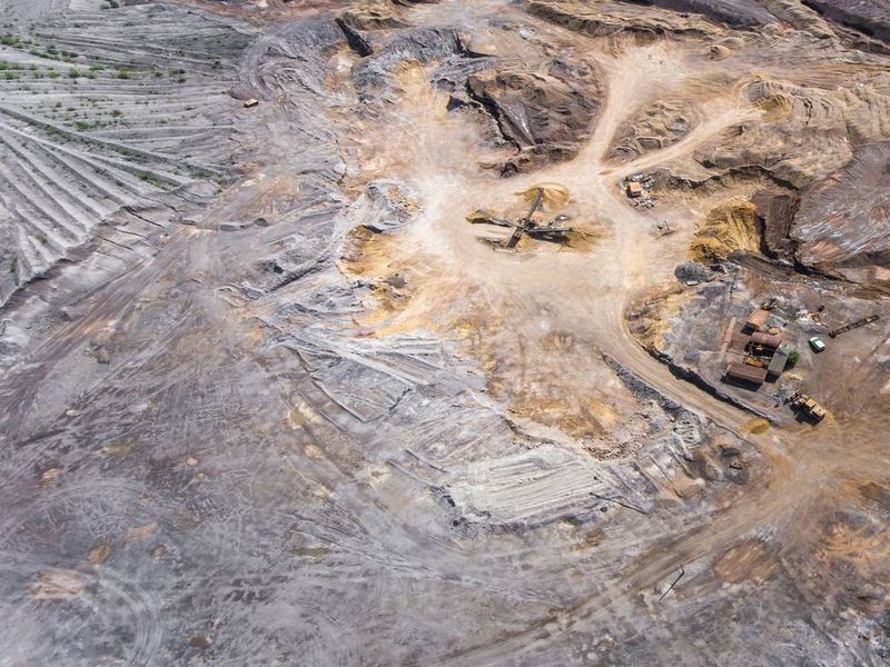
3D reconstruction
3D data can be turned into 3D models, point clouds, digital surface and terrain models, elevation maps, photorealistic reconstructions and more. These high-resolution aerial imagery outcomes provide volume, distance, surface area and elevation calculations used in mining operation planning, stockpile inventories, topography depiction and generating photorealistic models.
Map output
- 3D point cloud
- Orthomosaic
- Texture map
- Digital surface and terrain model (DSM, DTM)
- Contour lines

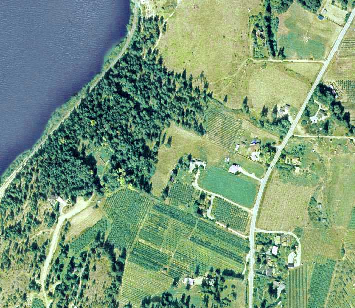
Multispectral imagery
Falcon’s Drone can collect multispectral data that can be turned into chlorophyll maps, NDVI layers, digital surface models or RGB single images. A resultant high-resolution aerial view map can be used for monitoring plant health and vigor, as well as evaluating surface properties, water flow and much more.
Map output
- Index map (NDVI)
- Chlorophyll map
- NDRE, OSAVI, NIR, CIR
- DSM
- Weeds ½
- RGB
Single images / orthophotos
Single aerial pictures collected by the Falcon’s Drone are used in various research areas. Combined with machine learning algorithms, individual aerial photos can transport massive amounts of information.
Map output
- Single images
Are you looking for
Survey
Ready to get started? Let's talk.
If you are in need of a residential land survey, commercial land survey or telecommunication land survey, Falcon Survey is the land surveying firm for your project.
About us
Falcon Survey Engineering Consultants is a pioneering Survey Engineering Company in UAE established in the year of 2007, built on a strong work ethic, honesty and a commitment to relationships. Today Falcon is one of the leading organizations in the field of Land Surveying, Soil Investigation, Ariel Survey (UAV/Drone Mapping), Bathymetric Survey (Hydrographic), Underground Surveying, 3D Laser Scanning Surveying, Calibration Services, Material Testing as well as Geographic Surveys which has International Standard and Quality
Quick Contact
-
#209, 2nd Floor, Apricot Tower
P.O. Box : 238544, Dubai Silicon Oasis
Dubai - United Arab Emirates