HOME > OUR SERVICES > AERIAL / DRONE MAPPING > CONSTRUCTION UPDATE SURVEY

AERIAL SURVEY APPLICATIONS

Construction Update Survey

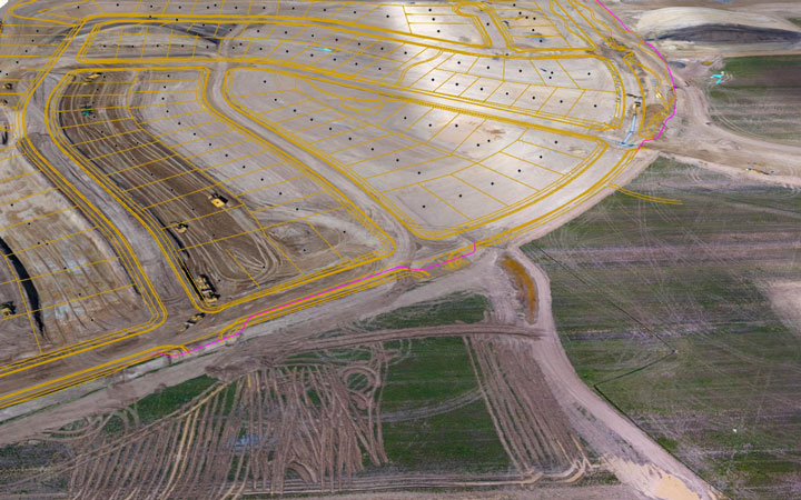
Create accurate, high-resolution drone maps, reports, 3D models, and real-time 2D maps for any construction site

Aerial Site Intelligence for Surveying & Construction

Save time, improve communication, and reduce cost by using drone data to perform surveys, conduct inspections, and document every job site. Using DroneDeploy’s drone data solution, customers gain the confidence to take their business to new heights. Through interactive digital maps and in-depth analysis, projects run on time, on budget, and safely.
drone survey company

Instant Insights

Capture data in real-time as the drone flies with Live Map.

Monitor Progress

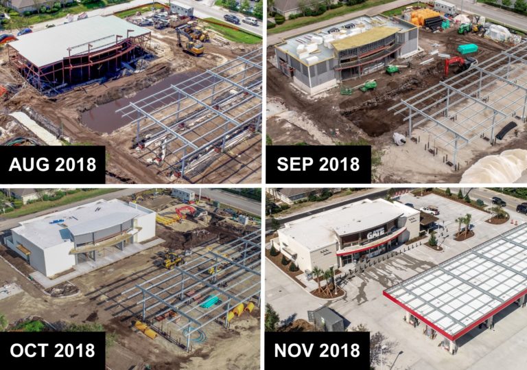
Evaluate project health with a visual timeline of a job site.

Fly Safely

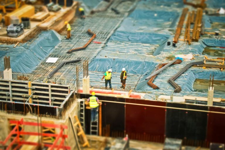
Analyze and mitigate risks without walking dangerous areas.

Explore the possibilities.

Get in touch with us to learn more about what a customized construction drone solution can do for you.

More and more players in the construction industry are turning to drones in order to reduce waste, optimize operations, and help projects stay on track. From eliminating the need for expensive manned aerial imaging to gathering highly accurate data, drones are helping key stakeholders on a job site deploy and manage resources more efficiently. You’re able to see data gathered in the field virtually anywhere you are through the cloud. You can create a safer environment for workers by getting into hard-to-reach or dangerous places quickly and efficiently with drones. The possibilities are endless.

Here are some of the ways you’ll find people using drones in construction right now:

Here are five ways drones are being used in construction operations right now.

1. Pre-Planning

Visual data collected by drone can help construction companies get a solid understanding of the entire site before they begin construction.

This pre-planning data can show possible drainage spots, changes in elevation, and other factors that can help determine the best places to build, dig, or stockpile materials. For example, if a map created with drone data reveals that a certain area is in a floodplain, that’s probably not the best place to build.

Drone data can also be used in pre-planning to give designers and architects a clear sense of how a new building might look next to an existing one, which helps them understand how the new project will impact the area from both a practical and an aesthetic viewpoint.

2. Keeping the Client in the Loop

Photos, videos, 3D models, and orthomosaic maps created with drone data can be used to provide clients with detailed, real-time reports on how things are progressing on-site.

On larger construction projects, there are often multiple stakeholders in multiple locations who are all eager to know how things are progressing.

Without a drone collecting visual data, clients would have to walk a site in person to see how things are moving along, or hire a helicopter at a prohibitively high cost to collect aerial shots or video. And even if they did take this step, the shots collected could be outdated after the next workday.

Given the relatively low expense of collecting visual data using a drone on a construction site, regular reports can now be sent to clients, helping them stay informed and happy about how things are moving along.

3. Safety

Since drones make the collection of visual data so much cheaper, construction companies can use drones in construction work to do aerial surveys more often, and this data can help them stay on top of changing conditions that may impact safety.

And safety on a construction site isn’t just about keeping workers safe—it’s also about finding access points where civilians could enter the work area and potentially hurt themselves.

Identifying a breach in the perimeter of a site on the same day it happens, instead of the next time someone walks by that specific area on foot, could make all the difference in preventing an accident.

4. Progress Monitoring

Maps created with drone data can be created regularly and sent to a project manager, who can use them to plan and monitor progress, a crucial part of avoiding delays that can cause a project to go over budget.

Drone imaging can be used to show erection sequences, crane locations, and perimeter security (i.e., gaps in fencing), and these sequences can be viewed regularly to pinpoint where projects are starting to get congested or delayed.
Are you looking for Survey

Ready to get started? Let's talk.

If you are in need of a residential land survey, commercial land survey or telecommunication land survey, Falcon Survey is the land surveying firm for your project.

About us

Falcon Survey Engineering Consultants is a pioneering Survey Engineering Company in UAE established in the  year of 2007, built on a strong work ethic, honesty and a commitment to relationships. Today Falcon is one of the leading organizations in the field of Land Surveying, Soil Investigation, Ariel Survey (UAV/Drone Mapping), Bathymetric Survey (Hydrographic), Underground Surveying, 3D Laser Scanning Surveying, Calibration Services, Material Testing as well as Geographic Surveys which has International Standard and Quality
Quick Contact

© Copyright 2022 Falcon Group - All Rights Reserved

Call Now Button