

Any Questions? Let’s talk
+971 4 3271414
Related Services
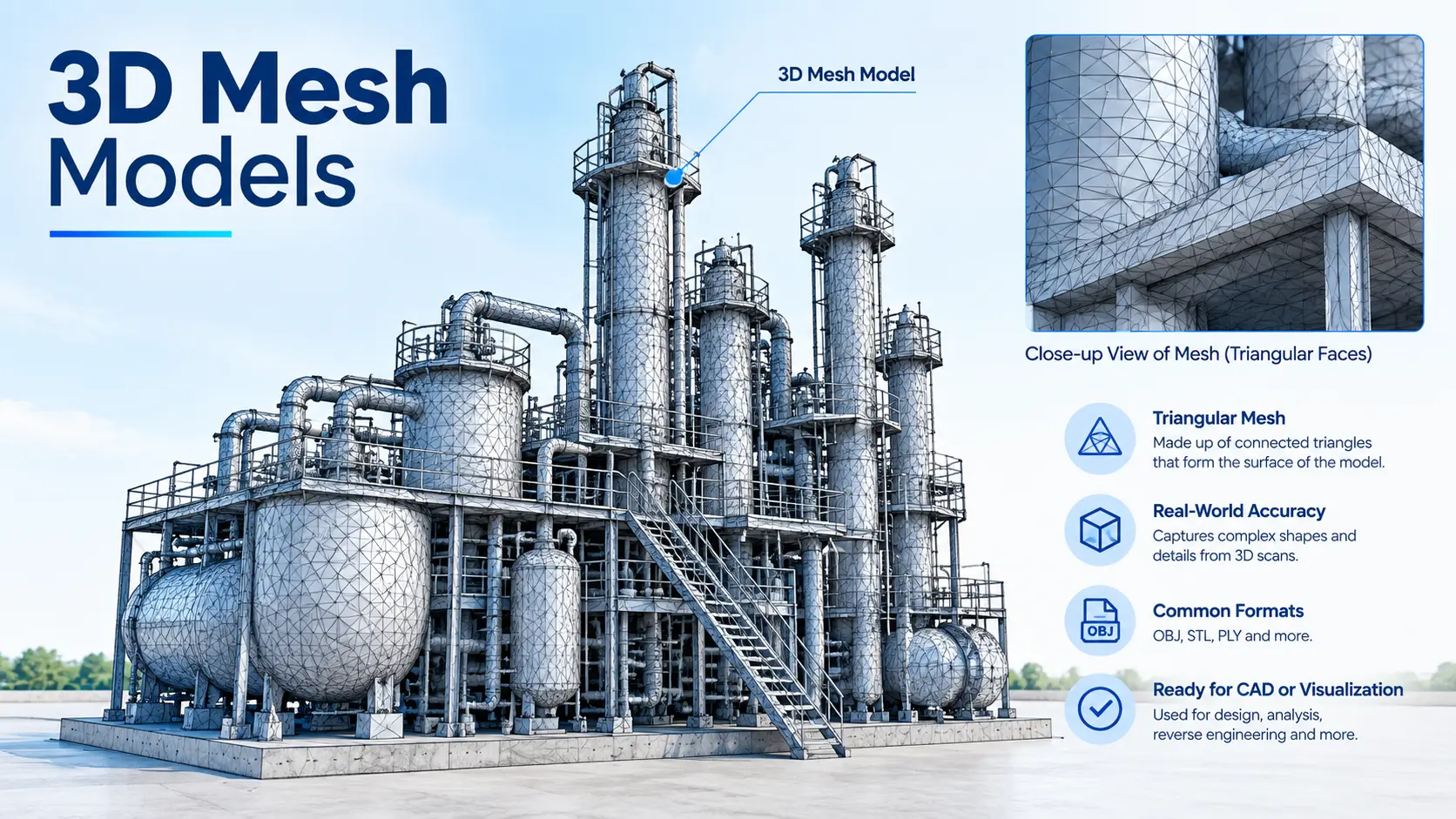
Creating Digital Reality with 3D Mesh Modeling
Accurate 3D Mesh Models from Point Cloud Data
3D laser scanning captures millions of points from an existing environment. These points can be processed and converted into a connected 3D mesh surface, creating a realistic digital representation of the scanned object or site.
Our mesh models can represent:
- Buildings and structures
- Industrial plants and facilities
- Machinery and equipment
- Architectural elements
- Roads and infrastructure
- Terrain and landscapes
- Bridges and tunnels
- Heritage and historic structures
- Large sites and construction areas
Our 3D Mesh Modeling Process
1. 3D Laser Scanning
We capture detailed spatial information using high-resolution 3D laser scanning technology.
2. Point Cloud Registration
Multiple scans are combined and aligned into a single registered point cloud.
3. Point Cloud Processing
The scan data is cleaned, organized, and prepared for mesh generation.
4. Mesh Generation
The point cloud is converted into a continuous 3D surface model.
5. Texture and Detail Processing
Where required, photographic information can be combined with the mesh to create a more realistic visual representation.
6. Quality Control & Delivery
The final mesh is checked and delivered in the required format for visualization, engineering, design, or other project requirements.
Applications of 3D Mesh Models
Architecture & Construction
Create realistic digital models of existing buildings, interiors, facades, and construction sites.
Industrial Facilities
Model plants, machinery, equipment, structures, and complex industrial environments for documentation and planning.
Infrastructure
Create detailed mesh models of roads, bridges, tunnels, structures, and surrounding terrain.
Heritage & Archaeology
Digitally preserve historic buildings, monuments, archaeological sites, and architectural details.
Topographic & Terrain Modeling
Generate detailed 3D surface models of land, earthworks, excavation areas, and large sites.
Inspection & Documentation
Use 3D mesh models to visually inspect and document existing conditions, surface details, and structural elements.
Visualization
Create realistic digital environments for presentations, simulations, virtual tours, and project visualization.
Industrial Applications
Volume Calculations
Infrastructure Applications
Architecture Applications
Archaeological/Heritage
Registered Point Cloud
3D CAD Models
3D Mesh Models
BIM Models
Plant Design Models
2D CAD Documentation
Orthophotos
3D Virtual Reality
Panoramic Images
Leica TruView
Reverse Engineering
2D/3D Floor Plan
Sectional Drawings
Facade/Elevation Building Survey
Measured Building Surveys
Concrete Scanning(Post Tension)
Stockpile Survey

Contact Info
- 209, 2nd Floor, Apricot Tower P.O. Box : 238544, Dubai Silicon Oasis Dubai - United Arab Emirates
- info@falconsurveyme.com
- +971 4 327 1414
- +971 4 327 1413
- Monday - Saturday: 08.00 AM to 06.00 PM | Sunday is Closed
Social Links