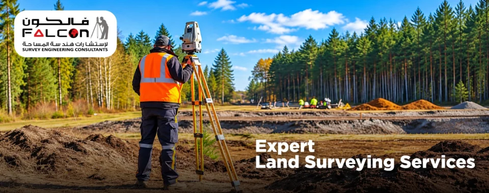
Each successful construction project start with a accurate understanding of the land. Before designing a building, developing a road, or preparing a construction site, it is essential to know the exact dimensions, boundaries, elevations, and physical features of the property. This is where professional land surveying plays a vital role in accurate project planning.
At Falcon Survey, we understand that reliable site information is the foundation of efficient construction. Through precise measurements and modern surveying technology, land surveyors help architects, engineers, developers, and contractors make informed decisions before work begins.
What Is Professional Land Surveying?
Professional land surveying is the process of measuring and mapping land to determine its position, dimensions, boundaries, elevations, and existing features. Surveyors use specialized instruments, including total stations, GNSS receivers, and other advanced surveying equipment, to collect accurate field data.
The collected information helps project teams understand the site conditions and prepare suitable designs, layouts, and construction plans. Depending on project requirements, survey deliverables may include boundary plans, topographical maps, contour maps, and construction setting-out data.
Why Is Land Surveying Important for Project Planning?
Accurate surveying provides the information needed to plan construction activities with greater confidence. Without reliable site measurements, even a well-designed project may face unexpected challenges.
1. Understand the Land Before Construction
Every site has its own characteristics, including slopes, elevation changes, existing structures, access routes, and natural features. A professional land surveying services helps identify these conditions before construction starts.
This information allows designers and engineers to evaluate the site, select suitable development approaches, and prepare plans that reflect actual ground conditions.
2. Establish Accurate Property Boundaries
Knowing the correct property boundaries is essential when planning buildings, roads, fences, and other infrastructure. Boundary surveying helps establish the surveyed property limits based on relevant records, measurements, and applicable requirements.
Accurate boundary information can help reduce the risk of encroachment, layout errors, and disputes during development.
3. Improve Design and Engineering Decisions
Architects and engineers need dependable measurements to create designs that fit the available site. Land surveying provides essential information about dimensions, levels, and existing features.
When survey data is incorporated into the design process, project teams can make better-informed decisions about building placement, access, drainage, grading, and infrastructure alignment.
4. Reduce Costly Construction Errors
Incorrect measurements or assumptions about site conditions can lead to rework, material wastage, and project delays. Professional surveying helps identify potential issues before they become expensive construction problems.
By providing accurate site data at the planning stage, surveyors help contractors and developers reduce avoidable errors and use project resources more efficiently.
5. Support Accurate Construction Setting Out
Once the design is approved, the planned positions of buildings, foundations, columns, roads, and other structures must be transferred to the ground.
Construction setting out uses survey control and design coordinates to establish these positions accurately. This helps construction teams follow the approved drawings and maintain the required alignment and levels throughout the project.
6. Assist with Elevation, Grading, and Drainage Planning
Changes in ground elevation can influence earthwork quantities, surface water flow, road gradients, and foundation design. Topographical surveys and contour mapping provide information about the existing terrain.
Engineers can use these details to develop grading plans, assess drainage requirements, and estimate cut-and-fill quantities before major earthwork begins.
7. Improve Coordination Between Project Teams
Accurate survey information creates a common reference for architects, engineers, consultants, and contractors. Consistent coordinates, levels, and site measurements help different teams coordinate their work more effectively.
Reliable survey data can also support CAD drawings, digital terrain models, and other project documentation used during design and construction.
Types of Land Surveying Used in Project Planning
Different projects require different surveying methods. The appropriate survey depends on the site, development objectives, design requirements, and applicable regulations.
- Boundary Survey: Identifies and verifies property boundaries using relevant records and field measurements.
- Topographical Survey: Maps terrain, elevations, contours, and visible site features.
- Construction Setting Out: Transfers approved design positions and levels onto the ground.
- Contour Survey: Represents changes in ground elevation to support grading and drainage design.
- As-Built Survey: Records the actual positions, dimensions, and levels of completed construction elements.
Selecting the appropriate survey at the right stage helps ensure that project teams receive the information they need.
How Modern Surveying Technology Improves Accuracy
Land surveying has advanced significantly with the use of modern instruments and digital workflows. Total stations enable precise angle and distance measurements, while GNSS technology supports positioning and control establishment where suitable.
Depending on project requirements, land surveyors may also use drones, laser scanning, and digital mapping techniques to capture larger areas or more detailed site information.
Choosing the Right Land Surveying Company
The quality of survey information can influence decisions throughout the construction process. When selecting a land surveying company, consider the following factors:
- Technical expertise: Choose a team experienced in the type of survey your project requires.
- Suitable equipment: Ensure the company uses appropriate surveying instruments and methods.
- Reliable deliverables: Confirm that drawings, coordinates, levels, and reports meet your project requirements.
- Project coordination: Look for surveyors who can communicate effectively with designers, engineers, and contractors.
A qualified surveying team can help establish a dependable foundation for planning, design, and construction.
By combining professional fieldwork with modern surveying technology, we aim to deliver accurate, practical survey information for construction, infrastructure, and land development projects across the UAE.
Whether you are preparing a site for a new building, planning infrastructure improvements, or evaluating existing land conditions, obtaining reliable survey data early can make a meaningful difference to your project.
Accurate project planning starts with accurate land information. Professional land surveying helps project teams understand site conditions, establish boundaries, coordinate designs, plan earthworks, and position construction elements correctly.
Investing in the right surveying services before construction begins can help reduce uncertainty, improve coordination, and support a smoother project workflow.