
Expert topographic survey services offer a comprehensive view of the locations of buildings and land. The survey examines and documents observable physical characteristics, both man-made and natural. Ground levels and contours are also recorded. This data is used by engineers, contractors, architects, and developers to find possible problems and cut expenses.
Every successful construction project begins with a clear understanding of the land. Before building a residential property, commercial complex, or industrial facility, it is essential to understand the site’s existing conditions. A professional topographical survey provides accurate information about ground elevations, slopes, contours, and visible natural and man-made features.
Here, our surveying solutions help architects, engineers, contractors, and developers make informed decisions, improve site planning, and reduce unexpected construction challenges.
What Is a Topographical Survey?
A topographical survey is a detailed assessment of a site’s physical features and ground levels. It records important details such as terrain variations, roads, buildings, boundaries where required, drainage features, and other visible site elements.
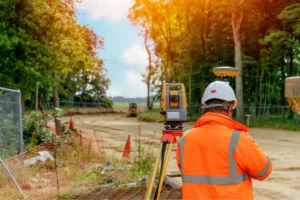
Using modern surveying equipment, including total stations, GNSS receivers, and drone survey mapping technology where suitable, surveyors collect accurate site data. This information is processed into topographical drawings, contour maps, and digital terrain models to support engineering design and construction planning.
Why Are Topographical Surveys Essential for New Construction?
-
Provides Accurate Site Information
One of the initial tasks in building planning is comprehending the terrain. A topographical survey finds slopes, height variations, and other factors that could affect the planned development.
With reliable site measurements, architects and engineers can prepare designs based on actual ground conditions rather than assumptions.
-
Supports Better Architectural Design
Every construction site has unique characteristics. Accurate survey data helps architects and engineers develop site layouts that respond to the terrain and surrounding features. Whether planning a residential building, commercial complex, office, or industrial facility, topographical information supports more effective design and site development.
-
Identifies Potential Site Constraints
Changes in ground elevation, existing structures, drainage features, and visible obstructions can affect construction activities. Identifying these conditions at an early stage helps project teams assess potential challenges before finalizing their designs.
A detailed topographical survey provides essential information for evaluating site constraints and coordinating proposed construction with existing conditions.
-
Helps Reduce Construction Costs and Errors
Inaccurate site information can lead to design revisions, unnecessary excavation, material wastage, and project delays. A reliable topographical survey helps reduce these risks by providing accurate measurements for planning and engineering calculations. Early access to dependable survey data can improve project coordination and support more efficient use of time and resources.
-
Improves Site Grading and Drainage Planning
Ground levels and natural slopes play an important role in surface water management. Topographical survey data helps engineers develop grading plans, assess drainage patterns, and determine suitable site levels. This information is particularly valuable for building developments, road projects, parking areas, and large infrastructure sites.
-
Supports Cut and Fill Calculations
Many construction projects require land leveling or excavation before building work begins. Topographical survey data can be used with proposed design levels to calculate cut and fill quantities. These calculations help contractors estimate earthwork requirements, plan material movement, and manage construction budgets more effectively.
-
Creates a Reliable Foundation for Engineering Design
Architects, civil engineers, landscape designers, and infrastructure planners can all benefit from topographical drawings. They assist with grading design, road alignment, site layout preparation, and other engineering tasks.
Accurate survey information also improves coordination between the different teams involved in a construction project.
When Should You Conduct a Topographical Survey?

A topographical survey is generally recommended during the initial planning and design stages, before finalizing construction layouts. It is useful for:
- Residential and commercial developments
- Industrial facilities and warehouses
- Road and infrastructure projects
- Land development and site preparation
- Drainage and grading design
- Earthwork and volume calculations
- Renovation and redevelopment projects
Conducting the survey early helps the project team understand the site before major design and construction decisions are made.
A topographical survey is a significant role of construction building preparation. By providing accurate information about terrain, elevations, slopes, and existing features, it helps project teams improve design, plan drainage, estimate earthwork quantities, and reduce avoidable construction risks.