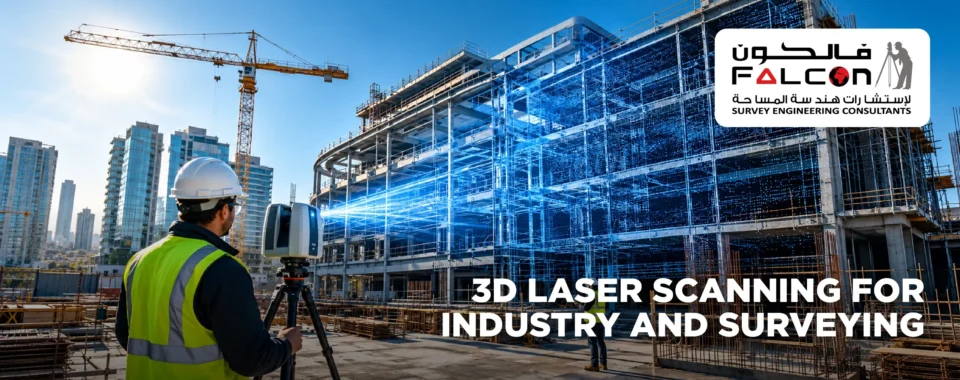
Modern construction, engineering, and industrial projects require accurate information about existing site conditions. Traditional measurement methods can be time-consuming, particularly when working with large facilities, complex structures, or difficult-to-access areas. Most 3D Scanning company offers an advanced solutions by capturing detailed spatial information and converting it into reliable digital representations.
For surveying of professionals, engineers, architects, and industrial project teams, this technology supports better planning, precise documentation, and more informed project decisions.
What Is 3D Laser Scanning?
3D Laser Scanning is a surveying technology of great 3d scanning company that captures the shape, dimensions, and spatial details of physical environments using laser measurements. The scanner records millions of measurement points to create a detailed dataset known as a point cloud.
This data can be processed into 3D models, CAD drawings, floor plans, sections, elevations, and other technical deliverables according to project requirements.
Unlike conventional measurement techniques that capture selected dimensions, laser scanning records extensive details of the surrounding environment. This makes it particularly useful for projects that demand comprehensive as-built documentation and accurate existing-condition data.
Key Applications of 3D Laser Scanning in Industry and Surveying
1. Industrial Plant Documentation
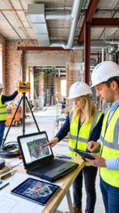
Complex machinery, pipes, structural frameworks, and integrated systems are frequently seen in industrial facilities. Planning improvements, maintenance tasks, or new installations requires precise measurements.
3D laser scanning services records the current state of the plant and generates comprehensive digital records of pipe routes, equipment layouts, and structural elements. This data can be used by engineers to evaluate available space, plan changes, and lower the possibility of design conflicts.
2. Construction and Building Surveys
Construction projects rely on accurate site information from the initial planning stage through completion. Laser scanning helps surveyors document existing buildings, structural elements, internal spaces, and external facades.
The collected data can support as-built drawings, renovation planning, dimensional verification, and comparisons between design information and actual site conditions.
For existing buildings, this approach is especially valuable when original drawings are unavailable or no longer reflect the current structure.
3. Infrastructure and Transportation Projects
Roads, bridges, tunnels, stations, and other infrastructure assets require reliable measurements for inspection, rehabilitation, and development.
3D Laser Scanning captures structural surfaces and surrounding features, providing detailed information for engineering assessments and project documentation. Survey teams can use the data to evaluate dimensions, record existing conditions, and support future maintenance planning.
Scanning can also help document areas where conventional measurements are difficult or where detailed surface information is required.
4. As-Built Documentation and CAD Modelling
During construction and renovation, actual site conditions may differ from the original design. Accurate as-built documentation helps project teams understand what has been installed and identify discrepancies that require attention.
Laser scanning data can be processed into 2D CAD drawings and 3D models that represent existing conditions. These deliverables are useful for architects, contractors, consultants, and facility managers who need dependable information for future work.
The level of detail and final output depend on the scanning scope, required accuracy, and project specifications.
5. Heritage and Architectural Documentation
Historic buildings and architectural landmarks often feature intricate details, irregular surfaces, and complex geometries. Recording these features through manual measurements can be challenging.
3D Laser Scanning provides a digital record of architectural elements, facades, decorative features, and structural dimensions. This information can assist with conservation planning, restoration design, historical documentation, and future condition assessments.
The resulting digital dataset helps preserve a detailed record of the structure without relying solely on traditional drawings.
6. Reverse Engineering and Equipment Replacement
In industrial environments, replacement components may need to be manufactured when original design files are missing or outdated. Laser scanning can capture the geometry of existing components, machinery, and mechanical assemblies.
The resulting data can support reverse engineering workflows, dimensional analysis, and the development of CAD models. Engineers can use these models as references when assessing replacement parts or planning modifications.
Additional engineering analysis may be necessary before the scanned geometry can be used for manufacturing.
7. Building Information Modelling (BIM)
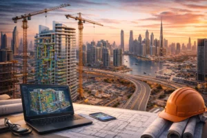
Building Information Modelling requires dependable information about the geometry and arrangement of building elements. Laser scanning can provide existing-condition data for creating or updating BIM models.
By using scanned information as a reference, project teams can develop digital representations of walls, floors, ceilings, structural components, and building services where captured and specified.
This process supports coordination between architects, engineers, contractors, and facility managers, particularly during refurbishment and renovation projects.
The value of laser scanning extends beyond collecting field measurements. Processed data can be transformed into different digital products to support specific design, construction, and documentation needs.
8. Registered Point Clouds
A registered point cloud combines scans captured from multiple positions into a unified dataset. It provides a detailed digital record of the surveyed environment and serves as the foundation for many subsequent deliverables.
9. 3D CAD Models
3D CAD models represent physical structures and components as digital geometry. Engineers and designers can use these models to understand dimensions, evaluate layouts, and plan modifications.
They are especially useful for industrial plants, mechanical installations, structural systems, and building renovation projects where accurate existing-condition information is needed.
10. BIM Models
Building Information Modelling (BIM) converts captured site information into a structured digital representation of a building or facility. Laser scanning can provide the geometric reference needed to create or update BIM models based on existing conditions.
Scan-to-BIM workflows can support architectural elements, structural components, and visible building services, depending on the scanning scope and modelling requirements.
BIM models are useful for renovation planning, design coordination, facility management, and identifying potential conflicts between building elements. The level of detail depends on the project specifications and intended use of the model.
11. 3D Mesh Models
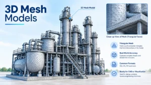
A 3D mesh model represents a scanned surface using connected polygons, commonly triangles. Depending on the workflow, the mesh may include texture or colour information to create a realistic digital representation of the object or environment.
Mesh models are useful for architectural visualization, complex surface documentation, heritage recording, and representing irregular shapes that are difficult to describe using simple geometric forms.
They can also support digital presentations and surface analysis when prepared to meet the project’s requirements.
12. Orthophotos
Orthophotos are geometrically corrected images that provide a consistent scale and minimise perspective distortion. In suitable workflows, imagery and scanning data can be processed to create orthographic views of building facades, walls, and other surfaces.
These outputs help architects, surveyors, and engineers examine surface details, record visible features, and support documentation and measurement tasks.
Orthophotos are particularly valuable when a project requires a clear visual reference of a facade or surface. Their accuracy depends on image quality, processing methods, and the available geometric data.
13. Panoramic Images
Panoramic images provide wide-angle visual records of indoor and outdoor environments. Captured during site documentation, they allow project teams to review surrounding conditions, equipment arrangements, architectural features, and site layouts.
When associated with scanning stations or spatial data, panoramic imagery can help users understand the context behind a point cloud and navigate documented spaces more easily.
These images are useful for remote site reviews, project communication, facility documentation, and visual records of existing conditions.
14. Facade and Elevation Drawings
Facade and elevation surveys record the external appearance and dimensions of buildings. 3D Laser Scanning captures visible architectural details, openings, wall surfaces, columns, decorative elements, and changes in the facade profile.
The scan data can be processed into measured elevation drawings and orthographic views that support renovation, restoration, architectural design, and building maintenance.
For complex structures, laser scanning can provide a more complete geometric reference than measurements taken from a limited number of points. Survey control and suitable processing help ensure that the final drawings meet the specified accuracy requirements.
Trusted 3D Scanning Company in UAE and Saudi Arabia
3D Laser Scanning plays an important role in construction, industrial, infrastructure, and architectural projects across the UAE and Saudi Arabia. This technology captures detailed site conditions and supports the creation of accurate point clouds, 3D models, BIM models, and as-built documentation for engineering and project planning. Falcon Survey provides advanced 3D Laser Scanning Services in the UAE and 3D Laser Scanning Services in Saudi Arabia to support diverse project requirements, from existing building documentation to complex industrial facilities.
3D Laser Scanning can help best 3d scanning company project teams capture existing conditions and convert spatial data into useful information for planning, design, and engineering.
Depending on project requirements, scanning deliverables may include registered point clouds, 2D CAD drawings, 3D models, BIM documentation, building elevations, sections, and as-built records.
Whether the objective is documenting an existing building, recording an industrial facility, supporting renovation work, or preparing data for engineering applications, choosing an appropriate scanning scope is essential for achieving useful results.