

Bathymetric Survey

+971 4 3271414
Related Services
Our surveys support marine construction, dredging, port development, coastal engineering, offshore projects, and waterway management across the UAE.
Hydrographic Survey Services provide accurate measurement, mapping, and analysis of underwater areas, including seabeds, riverbeds, waterways, ports, harbours, and coastal zones. Using advanced hydrographic surveying equipment and positioning technologies, we collect reliable data on water depths, underwater terrain, submerged features, and seabed conditions.
Our hydrographic surveys support marine construction, dredging, coastal development, port operations, navigation, and offshore infrastructure projects across the UAE.
The related marine survey services can then be properly organised underneath this main category.
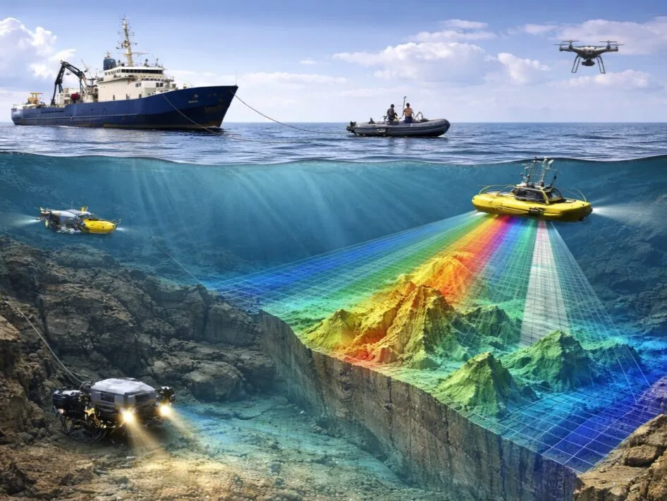
We provide accurate measurement and mapping of water depths, seabed topography and related underwater features to support marine engineering, dredging, reclamation, navigation, port development, coastal projects and other marine works.
Single Beam Echo Sounder – SBES Bathymetric Survey
Used for depth measurements along survey lines and suitable for various general bathymetric and profile surveys.
Multibeam Echo Sounder – MBES
Used for detailed, high-density seabed mapping and wider seabed coverage.
USV Bathymetric Survey
Bathymetric surveys performed using an unmanned/uncrewed surface vessel equipped with SBES or MBES, particularly useful in shallow or difficult-access waters.
Bathymetric LiDAR Survey
A specialised airborne/UAV-based method suitable mainly for shallow and sufficiently clear-water environments
Ports and Harbours > Navigation Channels > Dredging Projects > Reclamation Projects > Coastal Developments > Marine Construction > Pipeline / Cable Routes > Pre-Construction Surveys > Post-Construction / As-Built Surveys > Seabed Monitoring
Both above-ground structures and underwater terrain may need to be thoroughly surveyed for marine and waterfront developments. While bathymetric surveying captures underwater features, Falcon Survey’s 3D Laser Scanning Services help document buildings, industrial facilities, and infrastructure through detailed point cloud data, as-built documentation, and 3D modelling. These complementary surveying methods can support better project planning and coordination.
For construction, infrastructure, and industrial projects in Saudi Arabia, accurate digital documentation helps support planning, design coordination, and as-built records. Falcon Survey’s 3D Laser Scanning Services provide detailed point cloud data and 3D modelling solutions for suitable above-ground structures and facilities. These services can complement bathymetric surveys when projects require documentation of both underwater terrain and surrounding infrastructure.