

Any Questions? Let’s talk
+971 4 3271414
Related Services
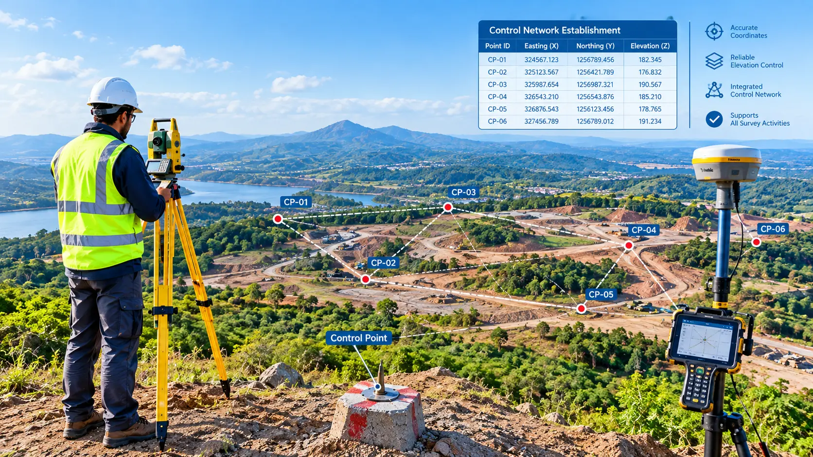
Establishing a Control Network for Surveying
Our Control Network Establishment services provide a reliable framework of precisely positioned horizontal and vertical control points across a project site. These control points serve as the foundation for surveying, construction staking, site development, mapping, and ongoing project verification.
By establishing a consistent survey control network at the beginning of a project, we help ensure that all subsequent survey and construction activities are referenced to the same accurate coordinate and elevation system.
Creating Networks for Survey Control
We create survey control networks made up of recognizable, stable sites connected by incredibly precise observations. Precise stations can be installed during building activities thanks to the control stations’ millimeter accuracy adjustment. Least Squares computations and conventional Total Stations and traversal methods can be used to create the control network. We can provide post-processing GPS observations to set up the control network if the location covers a large area. By employing a static receiver to gather GPS observations, this can be accomplished with millimeter accuracy. We provide measurement of national border markers as well as static monitoring to create national control networks.
Our Control Network Establishment Services
Horizontal Control
We establish accurately positioned horizontal control points using appropriate coordinate systems and survey methods. These points provide reliable references for positioning buildings, roads, utilities, and other site improvements.
Vertical Control
We establish benchmarks and elevation control points that provide consistent vertical references for grading, drainage, foundations, roads, utilities, and finished floor elevations.
Site-Wide Control Networks
For large developments, we establish multiple interconnected control points throughout the project to provide convenient and reliable survey access across the site.
Construction Control
Control points are strategically positioned to support ongoing construction staking and layout while minimizing the risk of disturbance or loss during construction.
Control Verification
Existing control points can be checked and verified before being incorporated into a project control network.
As-Built & Construction Verification Control
Established control can be maintained throughout construction to support as-built surveys, quality checks, and verification of completed work.
Why Establish Survey Control?
A reliable control network provides a common reference for everyone working on a project. It can help:
- Maintain consistent positioning throughout construction
- Reduce layout errors
- Improve coordination between survey teams
- Support accurate grading and elevation control
- Establish reliable building and infrastructure locations
- Simplify construction staking
- Support as-built documentation
- Provide repeatable reference points throughout the project
Topographical Survey
Boundary Survey
Aerial Survey
Road Survey
Control Point Establishment
Construction Staking
Volume Survey
GIS Mapping
Contour Mapping
Cut Fill Volume Analysis
Setting Out Survey For Land
Gate Level Computation
Control Network Establishment
GPR Underground Survey
Boundary Disputes Survey
Digital Terrain Modeling

Contact Info
- 209, 2nd Floor, Apricot Tower P.O. Box : 238544, Dubai Silicon Oasis Dubai - United Arab Emirates
- info@falconsurveyme.com
- +971 4 327 1414
- +971 4 327 1413
- Monday - Saturday: 08.00 AM to 06.00 PM | Sunday is Closed
Social Links