

Any Questions? Let’s talk
+971 4 3271414
Related Services
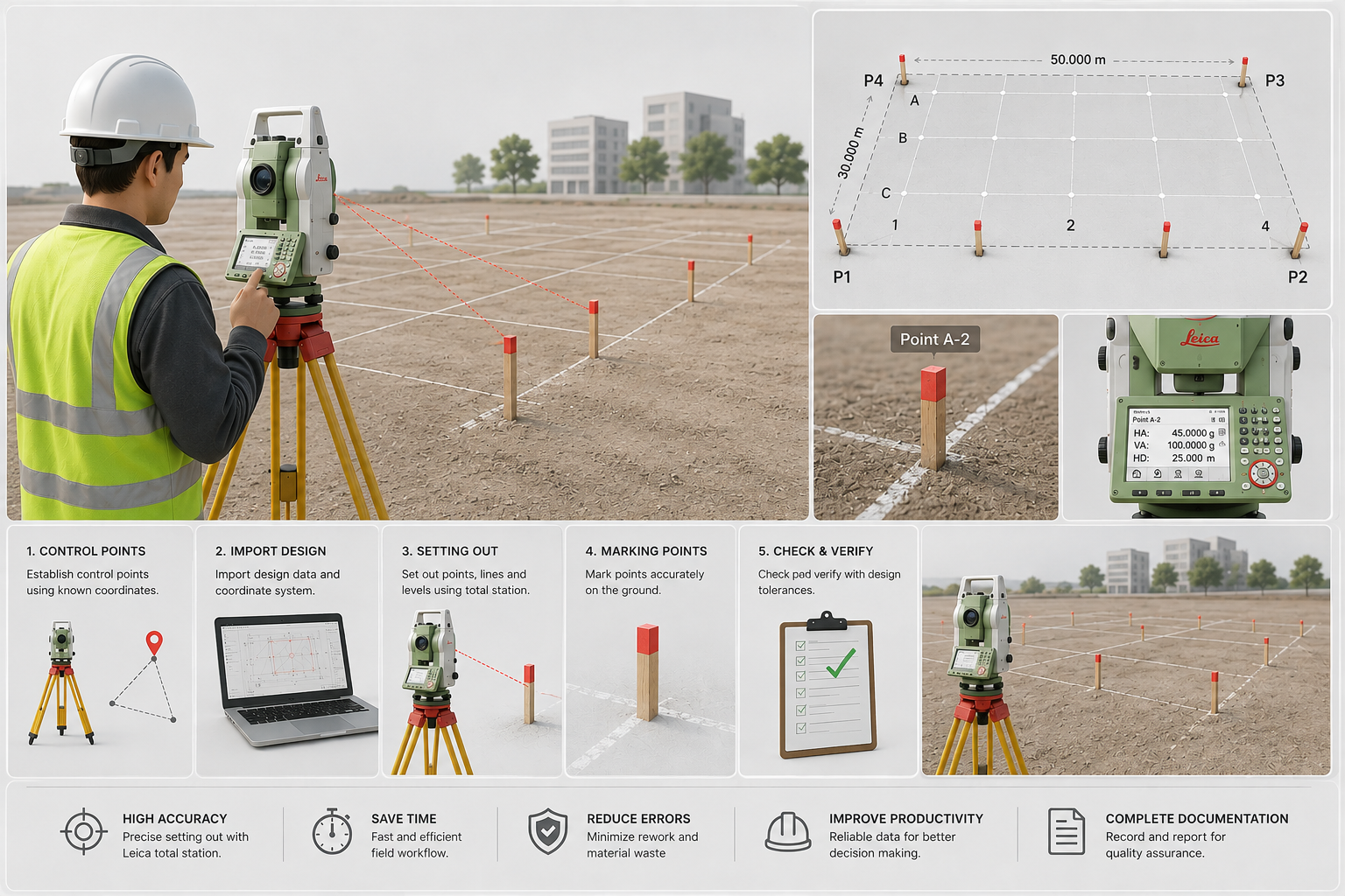
Our Setting Out Survey for Land services provide accurate positioning of property boundaries, building locations, site features, and proposed construction elements on the ground. Using precise surveying instruments and approved project drawings, we transfer design coordinates and dimensions from plans to the physical site.
What Is a Setting Out Survey?
A setting out survey, also known as construction staking or site setting out, involves transferring the positions and elevations shown on engineering or architectural drawings onto the actual land.
Surveyors establish reference points and mark the required locations so that construction teams can work according to the approved design.
Our Land Setting Out Survey Services
Building Setting Out
We accurately establish the position, orientation, and dimensions of proposed buildings based on architectural and engineering drawings.
Foundation Setting Out
Foundation corners, centerlines, excavation limits, and structural reference points are marked on the ground before excavation and construction.
Boundary & Property Setting Out
We establish and mark relevant property boundary points and offsets based on available survey information and legal/property documentation.
Road & Alignment Setting Out
Road centerlines, edges, curves, alignments, and other roadway features can be transferred from design drawings to the site.
Utility Setting Out
We can establish the locations and alignments of proposed drainage, water, sewer, electrical, and other underground or site utilities.
Level & Elevation Setting Out
Required elevations, benchmarks, formation levels, and finished floor levels can be established to support accurate construction.
Setting Out Surveyor Responsibilities
A surveyor’s responsibilities are more comprehensive and include both the early phases of the project (before to construction) and the whole project lifespan. Typically, surveyors measure land, establish legal borders, and provide information that helps with project design and planning. Additionally, they keep an eye on the building process to make sure the original designs are followed.
Key Responsibilities:
- Measuring boundaries, property, and land, frequently with the use of cutting-edge techniques like GPS, total stations, and 3D scanners.
- Supplying topographical surveys to assist engineers and architects in project design.
- Confirming that the built work complies with land titles and legal boundaries.
- Providing geographic information to support zoning, development, and planning decisions.
Advanced Surveying Equipment
We use modern surveying technology to provide accurate site positioning and construction control. Depending on project requirements, our surveys may utilize Total Stations, GNSS/GPS surveying equipment, digital levels, and CAD-based coordinate data.
Reliable Construction Setting Out
Accurate construction begins with accurate positioning. Our Setting Out Survey for Land service provides contractors, engineers, architects, and developers with reliable reference points for translating design drawings into physical construction.
From initial site preparation and foundation setting out to roads, utilities, and final construction elements, we provide survey support throughout the project.
Topographical Survey
Boundary Survey
Aerial Survey
Road Survey
Control Point Establishment
Construction Staking
Volume Survey
GIS Mapping
Contour Mapping
Cut Fill Volume Analysis
Setting Out Survey For Land
Gate Level Computation
Control Network Establishment
GPR Underground Survey
Boundary Disputes Survey
Digital Terrain Modeling

Contact Info
- 209, 2nd Floor, Apricot Tower P.O. Box : 238544, Dubai Silicon Oasis Dubai - United Arab Emirates
- info@falconsurveyme.com
- +971 4 327 1414
- +971 4 327 1413
- Monday - Saturday: 08.00 AM to 06.00 PM | Sunday is Closed
Social Links