The Foundation of Accurate Underwater Mapping
Understanding underwater environments is essential for marine construction, port development, coastal engineering, and offshore infrastructure projects. A hydrographic bathymetric survey provides detailed information about water depths, seabed elevations, underwater features, and marine conditions that influence project planning and execution.
By combining hydrographic data collection with bathymetric measurements, survey professionals can develop accurate representations of underwater terrain. These insights help engineers, marine planners, and construction teams make informed decisions before carrying out activities in challenging aquatic environments.
What Is a Hydrographic Bathymetric Survey?
A hydrographic bathymetric survey is a specialized marine surveying process that combines water depth measurement with the collection of spatial information about underwater environments.
Bathymetry focuses on measuring water depths and mapping the shape and elevation of the seabed, while hydrography covers a broader range of marine surveying activities, including depth measurements, seabed features, tidal observations, and underwater positioning.
Together, these surveying methods provide essential information for understanding underwater terrain and supporting marine engineering requirements.
Key Applications of Hydrographic Bathymetric Surveys
Reliable underwater data is important for projects where seabed conditions and water depths directly influence engineering decisions. A hydrographic bathymetric survey supports several marine and coastal applications.
- Port and Harbour Development: Evaluating existing water depths, seabed elevations, and underwater obstructions for port construction and expansion.
- Dredging and Channel Maintenance: Identifying depth variations and monitoring seabed levels before and after dredging operations.
- Coastal Engineering: Understanding underwater terrain to support shoreline protection and coastal infrastructure projects.
- Offshore Infrastructure: Providing seabed information for offshore installations and marine construction planning.
- Marine Navigation: Identifying shallow areas, submerged obstacles, and underwater features that may affect vessel movement.
Technologies Used in Hydrographic Bathymetric Surveys
Modern hydrographic surveying uses specialized acoustic instruments, positioning systems, and advanced survey platforms to collect accurate underwater information.
Multibeam Echo Sounder (MBES)
Multibeam Echo Sounders collect depth measurements across multiple beams, covering a wider seabed area during each survey pass. This technology supports high-resolution bathymetric mapping and detailed underwater terrain modelling.
Single Beam Echo Sounder (SBES)
Single Beam Echo Sounders measure water depth directly beneath the survey vessel. They are suitable for targeted depth measurements and surveys conducted along predefined survey lines.
USV Bathymetry for Remote Underwater Data Collection
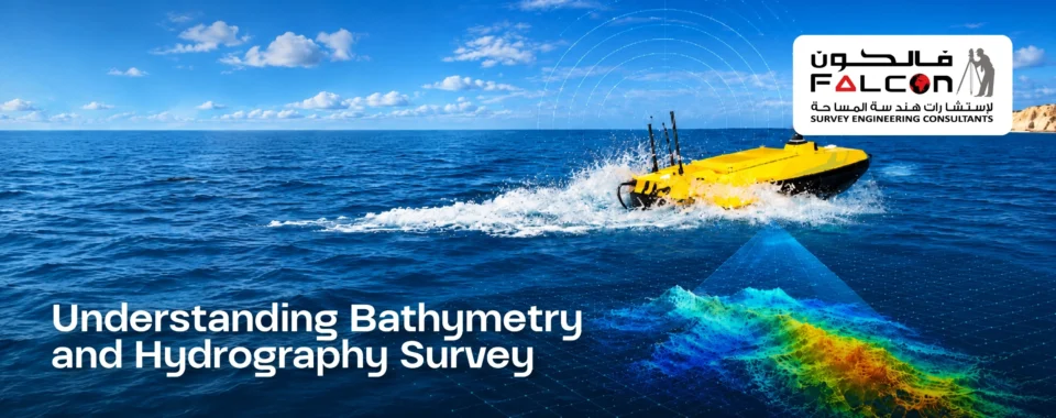
USV bathymetry uses uncrewed surface vessels equipped with hydrographic instruments to collect underwater depth measurements. These platforms can support surveys in shallow waters, restricted waterways, and locations where conventional survey vessels may face operational limitations.
When integrated with GNSS positioning and echo sounders, USVs provide a flexible approach to bathymetric data acquisition while reducing the need for personnel to operate directly from the survey vessel.
GNSS Positioning and Data Integration
High-precision GNSS positioning establishes the geographical coordinates of collected survey measurements. Combined with acoustic depth data, positioning information supports accurate seabed mapping and the development of spatially referenced bathymetric models.
Choosing the Right Bathymetric Survey Company
Selecting an experienced bathymetric survey company is important for obtaining reliable underwater information. Survey requirements can vary depending on water depth, seabed characteristics, project size, and the intended engineering application.
Professional bathymetric survey services typically involve:
- Survey planning and selection of appropriate equipment.
- Hydrographic data acquisition and depth measurements.
- Seabed elevation mapping and underwater feature identification.
- Positioning and processing of collected survey data.
- Preparation of bathymetric charts and digital terrain models.
- Comparison of survey results for seabed change monitoring.
The selection of suitable equipment and surveying methods helps ensure that the collected information meets the technical requirements of each project.
How Hydrographic Bathymetric Data Supports Marine Engineering
The information obtained through hydrographic and bathymetric surveys plays an important role in marine engineering and infrastructure development.
For example, port development projects require accurate underwater depth information to assess existing seabed conditions and determine potential dredging requirements. Similarly, offshore construction projects depend on seabed mapping to understand underwater elevations and identify features that could influence installation activities.
Bathymetric charts, digital elevation models, and seabed profiles allow engineering teams to interpret underwater conditions more effectively. Repeated surveys can also help identify changes in seabed levels caused by sediment movement, erosion, or dredging activities.
Falcon Survey for Hydrographic and Bathymetric Surveying
Falcon Survey delivers specialized surveying and geospatial solutions for marine, coastal, and offshore project requirements. Through modern surveying technologies and professional data processing approaches, Falcon Survey supports underwater depth measurement, seabed mapping, and hydrographic data collection.
From port and harbor development to coastal engineering and offshore investigations, accurate hydrographic bathymetric survey data helps provide a clearer understanding of underwater environments and supports informed project planning.