HOME > OUR SERVICES > AERIAL / DRONE MAPPING > MINING & AGGREGATES

AERIAL SURVEY APPLICATIONS

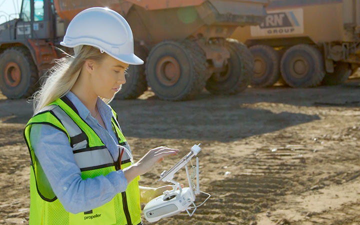
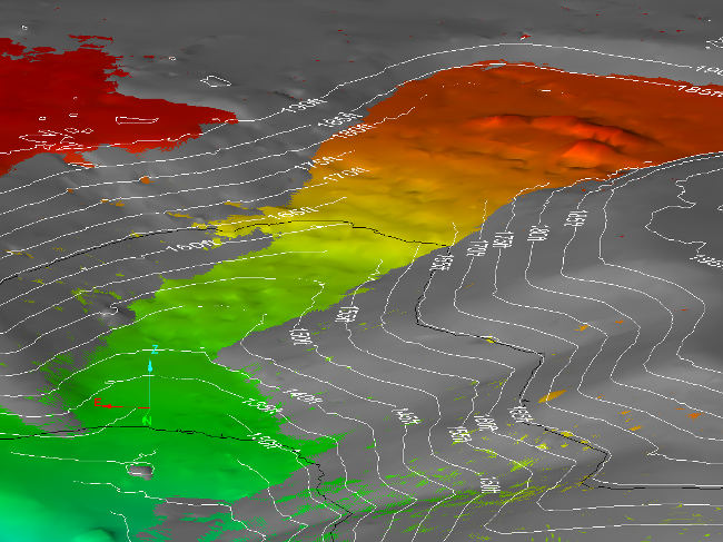
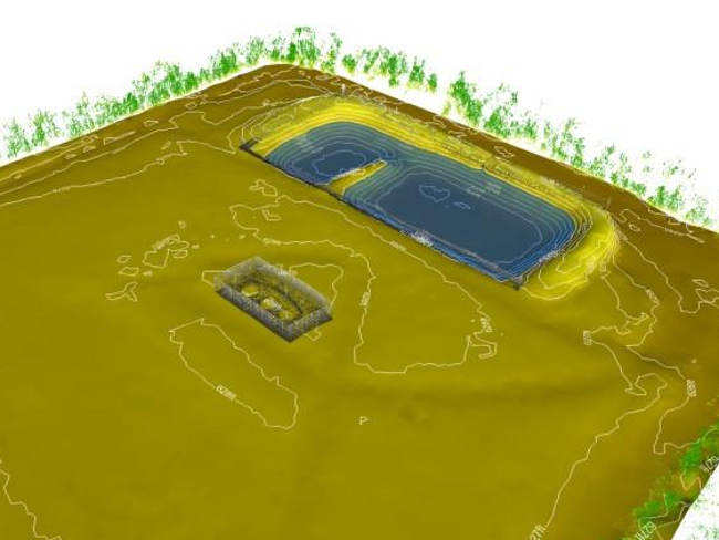
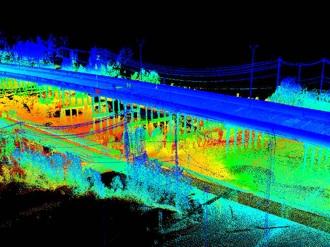
Mining and aggregates

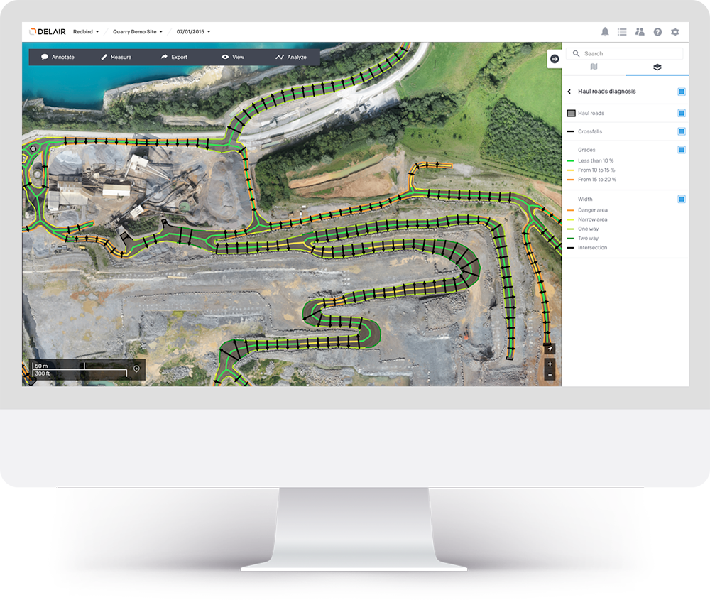
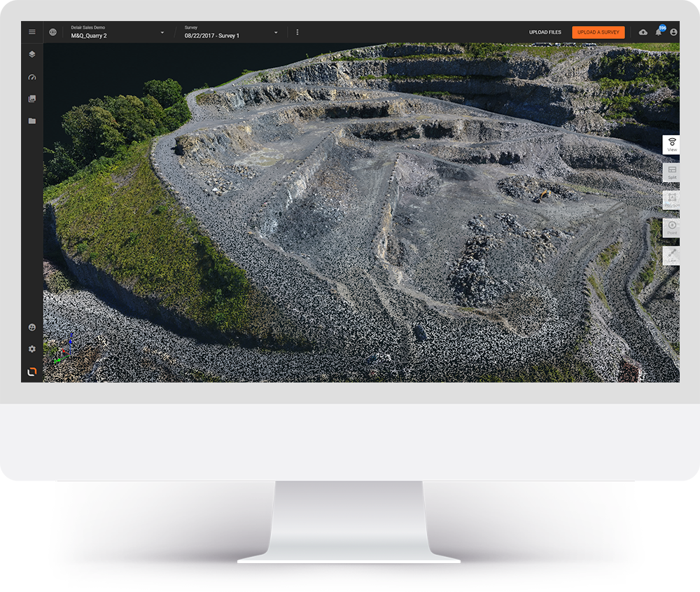
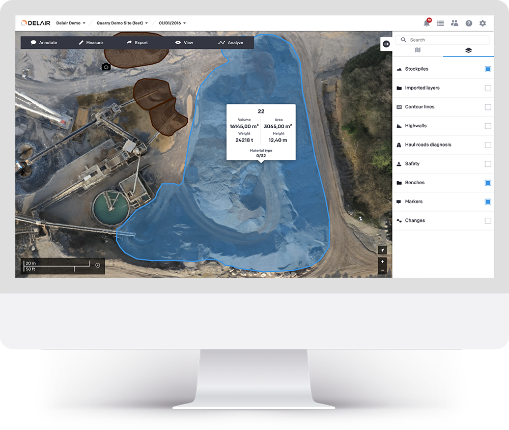
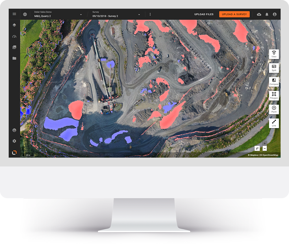
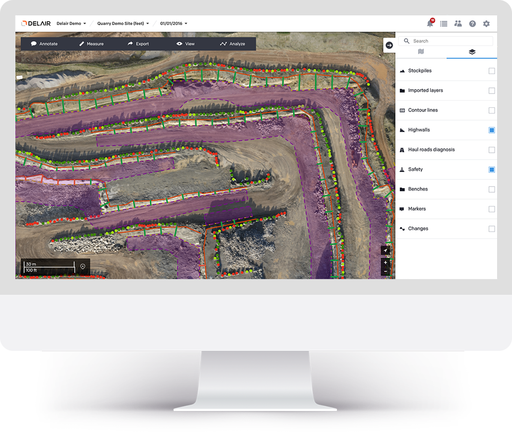
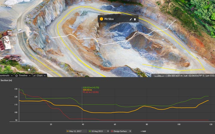
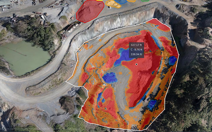
Drones Survey is used for mining in improvement with the overall efficiency of large space of mine site and target management by providing accurate and broad rich data detailing survey site conditions in a very short time and fast accessibility. They are also support better help to among teams onsite and internationally, offering dynamic oversight of all operations.

WHY USE DRONES IN MINING?

Nowadays drone survey refers to the use of a drone (or UAV – advanced aerial vehicle) equipped with a downward-facing highly rich camera to capture images of a site from different vantage points. We are using photogrammetry system software can relocate geo-referenced 3D maps, contour lines digital terrain models or digital surface models of the mining site.

Mining Survey operators can also easily extract the precise volume of stockpiles or areas to be excavated. Some advanced mining software can also generate industry-specific data such as safety guide rule and term heights; crests and toes; road boundaries; width; crests; slope, length, height and elevation change.

Apart of this, artificial intelligence in the software can automatically highlight those that do not comply with standards or constitutes a potential threat to the workers’ safety.

Drone Solutions for Mines and Aggregates

Key Applications

Use aerial data to increase efficiency and accuracy of stockpile management, inspections, and excavation while keeping your team safe and compliant

AERIAL SURVEY

Get Accurate Stockpile Volumes with Drone Surveying

Learn how drone photogrammetry will assist you affordably survey and live stockpiles quicker and even as accurately as ancient mensuration.

Mines around the world get the maximum ROI out of their drone operations. Reduce cost and streamline workflows with its reliable data processing, intuitive design, and accurate progress tracking tools.
The Drone mapping improves mine efficiency and enables better collaboration, while reducing cost and safety risks. Accessible from your web browser, you can measure stockpile volumes, check road grades, generate topo maps, and track progress against design in minutes. With the Software it’s easily establish accurate, reliable ground control.

Track progress against design

Upload design surfaces to visually track progress against your 3D site survey and see how far you’ve got to go. Compare one survey to another to see changes over time. Spot nonconformance issues before they become expensive.

Accurately calculate stockpile and pit volumes in seconds

Forget sending someone out to walk a pile. Measure your volumes in seconds on the Propeller Platform. Shave hours off your workflow and get better estimates on your inventory. Make huge write-offs a thing of the past.

Save time and reduce risk

Fly as often as you need. Complete site surveys in hours instead of days. Get your results in 24 hours. Use Propeller to plan blasting and extraction and monitor haul roads with easy-to-use measurement tools and 3D visuals.

Change Detection

Collecting high-density special knowledge may be a rather more correct technique than single-point measurement for observation changes within the earth’s surface. Valleys, troughs, toes and crests area unit captured in a lot of higher detail. Our optical device scanning instrumentality may be a quicker and safer suggests that of field measurement.

Drainage Studies

An accurate hydraulic model always starts with the right existing topography. Whether it’s undeveloped land, a highly disturbed area or natural drainage paths, we can capture, contour and deliver the data that builds your model.

Roadway Scanning

Falcon Survey can provides scans of sections of roadways, including access roads, for cut and fill calculations. Scans are captured using survey control from the highway project to localize the data. Deliverables include contours, ground points of the digital terrain model and the full resolution scan files.
Are you looking for Survey

Ready to get started? Let's talk.

If you are in need of a residential land survey, commercial land survey or telecommunication land survey, Falcon Survey is the land surveying firm for your project.

About us

Falcon Survey Engineering Consultants is a pioneering Survey Engineering Company in UAE established in the  year of 2007, built on a strong work ethic, honesty and a commitment to relationships. Today Falcon is one of the leading organizations in the field of Land Surveying, Soil Investigation, Ariel Survey (UAV/Drone Mapping), Bathymetric Survey (Hydrographic), Underground Surveying, 3D Laser Scanning Surveying, Calibration Services, Material Testing as well as Geographic Surveys which has International Standard and Quality

Quick Contact

© Copyright 2022 Falcon Group - All Rights Reserved.

Call Now Button