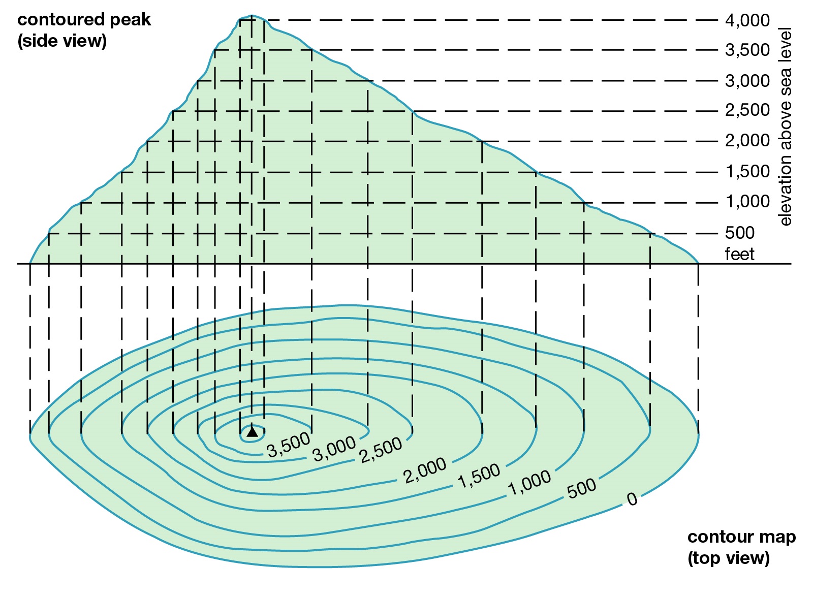
Topographical Survey
A topographical survey is an accurate depiction of a site which is scaled according to the spatial considerations and is the summary of on-site data

Home > Our Services > Land Survey > Topographical Survey
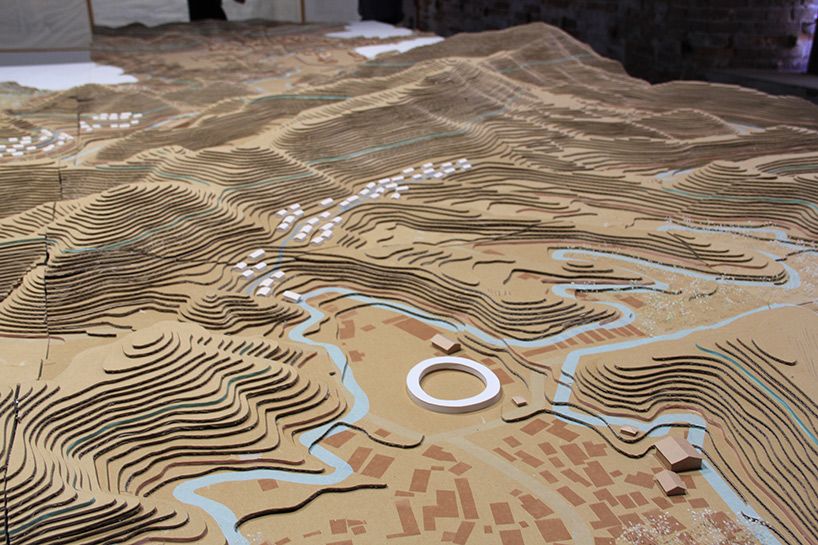
We produce accurate land and site surveys that capture all visible physical features — from boundaries and buildings to trees, levels, and services. Our surveys are tailored to your needs and delivered in formats compatible with CAD, Revit, and GIS.
Our Surveys Include:
Building outlines and heights, Ground levels and contours Trees, fences, walls, roads, Drainage covers and utilities, Surface materials and spot heights, Watercourses, embankments, ditches and many more.
We offer detailed floor plans, elevations, and cross-sections for existing structures. Perfect for refurbishments, extensions, or Building Information Modelling (BIM).
Utility Surveys (Underground)Using GPR and electromagnetic detection, we map underground pipes and cables. Often combined with topographical surveys for complete site visibility.
GPS & Control Network EstablishmentWe set up high-accuracy control points for construction, monitoring, and geospatial referencing using GNSS and Total Station technology.
Drone/UAV SurveysWe use drones to efficiently survey large or hard-to-access sites. Photogrammetry and LiDAR options available for orthophotos, digital terrain models (DTMs), and volumetric analysis.
These surveys are essential for architects, engineers, developers, and planners, providing the foundation for successful site design and development.
Why Do You Need a Topographical Survey?✔️ Planning Applications – Support your planning submission with accurate site data
✔️ Architectural Design – Understand site constraints and levels for new builds or extensions
✔️ Engineering Projects – Aid in drainage, road, and foundation design
✔️ Land Development – Plan infrastructure, subdivisions, and site layout.
✔️ Dispute Resolution – Clarify land ownership, boundaries, or encroachments.
We use the latest in GPS, GNSS, Total Station, and UAV (drone) technologies to ensure high-precision data capture and efficient service delivery. All surveys are conducted by qualified professionals following industry standards.
We understand the importance of timelines in construction and development. Our team is committed to delivering accurate topographic data quickly and efficiently with flexible scheduling to suit your project’s timeline.