

Any Questions? Let’s talk
+971 4 3271414
Related Services
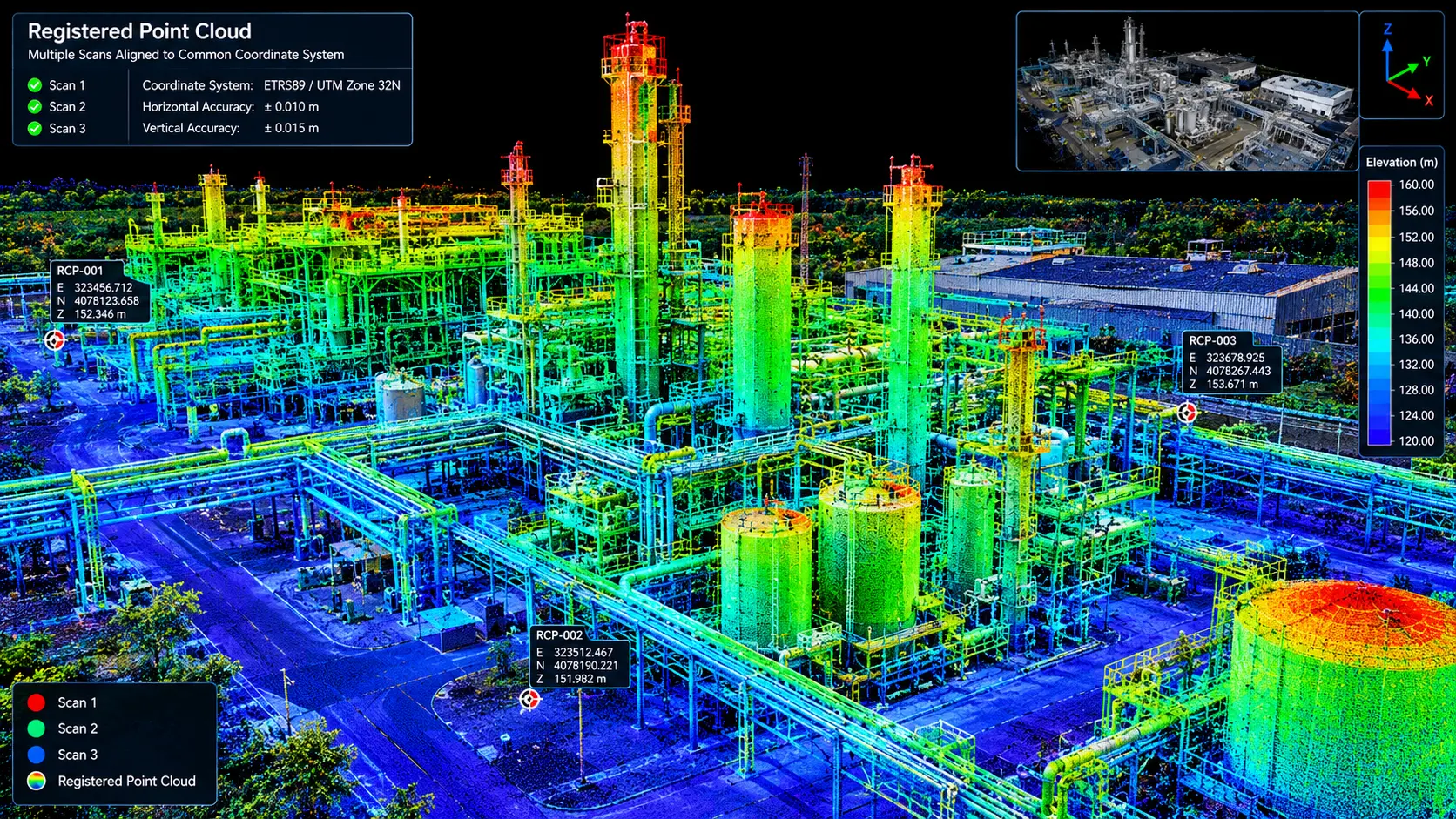
A registered point cloud is a unified 3D dataset created by combining multiple laser scans into a single, accurately aligned coordinate system. It provides a detailed digital representation of existing buildings, structures, terrain, equipment, and other surveyed environments.
Our registered point cloud survey services transform individual laser scans into a complete and coordinated dataset that can be used for architectural, engineering, construction, industrial, infrastructure, and heritage projects.
Accurate 3D Point Cloud Registration
During a 3D laser scanning survey, multiple scans are typically collected from different locations to capture the entire project area. These individual scans are registered together using common reference points, targets, or control coordinates.
The resulting registered point cloud provides:
- Unified 3D survey data
- Accurate spatial alignment
- Complete site coverage
- Detailed surface information
- Coordinate-referenced survey data
- A reliable foundation for CAD and BIM workflows
- Registered Point Cloud Applications
Registered point clouds can support a wide range of surveying and engineering applications, including:
Architectural Documentation
Generate accurate floor plans, elevations, sections, and 3D models from existing buildings.
BIM & 3D Modeling
Use point cloud data as a reference for creating BIM and detailed 3D models of existing conditions.
Industrial Plant Survey
Document equipment, piping, structural steel, machinery, and complex industrial environments.
Infrastructure Survey
Capture roads, bridges, tunnels, railways, and other infrastructure assets.
Heritage Documentation
Preserve detailed digital records of historic buildings, monuments, archaeological sites, and architectural features.
Construction Verification
Compare installed conditions with design models and monitor construction progress.
Topographic Survey
Create terrain models, contours, profiles, and surface information from registered scan data.
Why Choose a Registered Point Cloud Survey?
A properly registered point cloud provides a complete and measurable digital representation of existing conditions, reducing the need for repeated field measurements and providing project teams with reliable spatial information for design, coordination, documentation, and analysis.
Industrial Applications
Volume Calculations
Infrastructure Applications
Architecture Applications
Archaeological/Heritage
Registered Point Cloud
3D CAD Models
3D Mesh Models
BIM Models
Plant Design Models
2D CAD Documentation
Orthophotos
3D Virtual Reality
Panoramic Images
Leica TruView
Reverse Engineering
2D/3D Floor Plan
Sectional Drawings
Facade/Elevation Building Survey
Measured Building Surveys
Concrete Scanning(Post Tension)
Stockpile Survey

Contact Info
- 209, 2nd Floor, Apricot Tower P.O. Box : 238544, Dubai Silicon Oasis Dubai - United Arab Emirates
- info@falconsurveyme.com
- +971 4 327 1414
- +971 4 327 1413
- Monday - Saturday: 08.00 AM to 06.00 PM | Sunday is Closed
Social Links