

Any Questions? Let’s talk
+971 4 3271414
Related Services
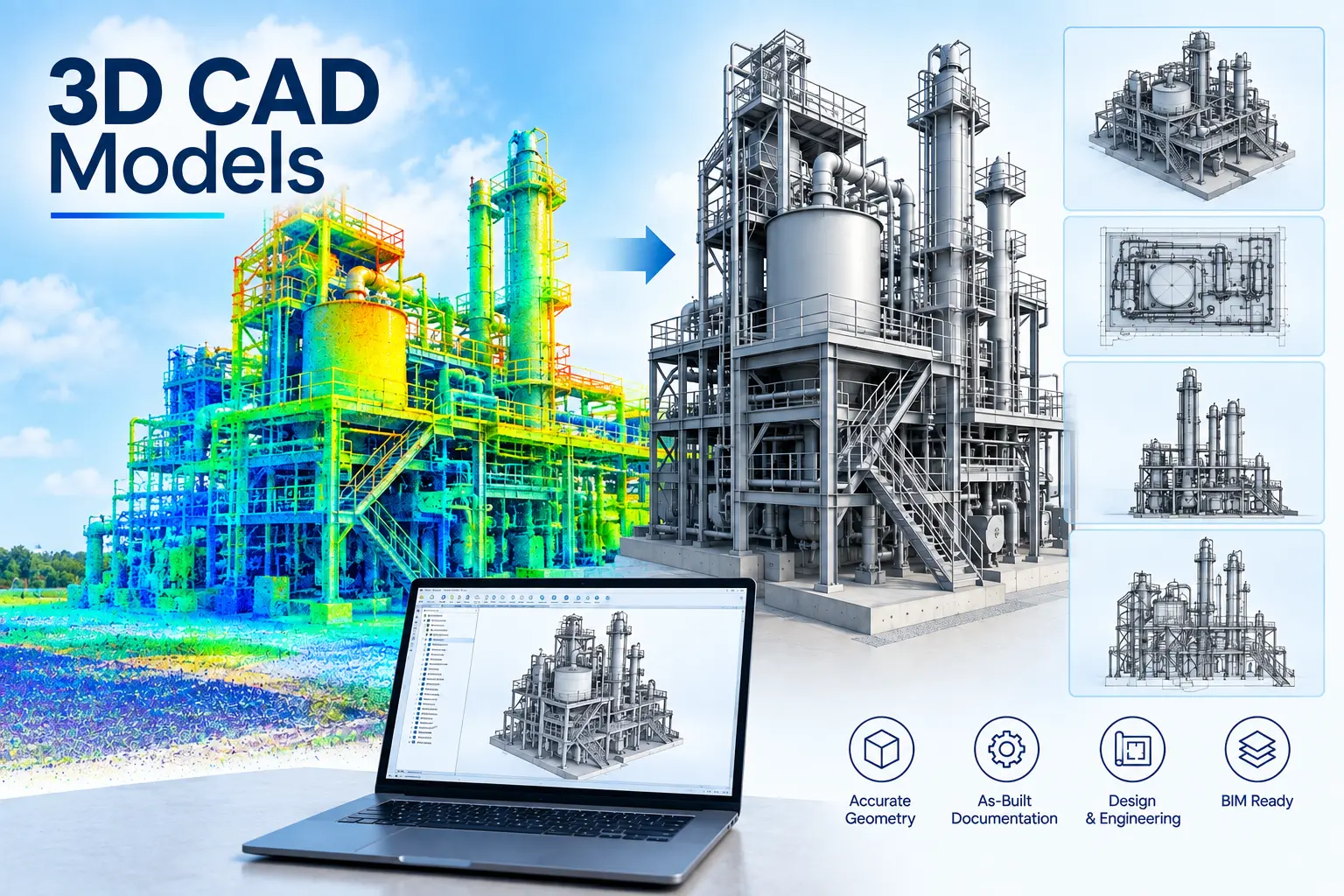
From Reality to Digital: 3D Modeling Through Laser Scanning
Transform detailed laser scan data into accurate, intelligent 3D CAD models for architecture, engineering, construction, industrial facilities, infrastructure, and heritage projects. Our 3D CAD modeling services use registered point clouds as a reliable reference to create precise digital representations of existing conditions.
Whether you need an as-built model, architectural documentation, structural model, plant layout, or engineering design reference, our CAD modeling workflow converts complex point cloud data into practical, editable CAD deliverables.
Accurate CAD Models from Point Cloud Data
Laser scanning captures millions of points from the existing environment. We process and interpret this registered point cloud to develop detailed CAD models that reflect the actual geometry of the surveyed site.
Our 3D CAD modeling can include:
- Buildings and architectural elements
- Structural components
- Industrial equipment
- Pipework and piping systems
- Steel structures
- Mechanical components
- Roads and infrastructure
- Heritage structures
- Plant layouts
- Site features and terrain
3D Scanning and CAD Modeling
The combination of 3D laser scanning and CAD technology helps designers, engineers, and businesses create accurate digital models quickly and efficiently. 3D scanning captures detailed information from real-world objects, buildings, and structures, which can then be used to create and edit CAD models.
Improved Accuracy
One of the main benefits of using 3D scanning with CAD is high accuracy. Traditional measurements can sometimes involve human errors, especially when working with complex shapes or large structures. 3D laser scanning captures millions of measurement points, providing detailed and reliable data for CAD modeling.
Faster Design and Modeling
Creating a detailed model manually can take a lot of time. With 3D scanning, existing objects or spaces can be captured quickly and converted into a digital model. The CAD model can then be modified, updated, or used for design and engineering work, helping to reduce overall project time.
Applications in Architecture and Construction
3D scanning is widely used in architecture and construction to document existing buildings and structures. Scan data can be used to create accurate floor plans, elevations, sections, and 3D CAD models. This helps architects and engineers understand existing conditions and make better design decisions.
Applications in Engineering and Manufacturing
In manufacturing and engineering, 3D scanning can capture the exact shape and dimensions of components, machinery, and equipment. The scanned data can be converted into CAD models for design, inspection, reverse engineering, modification, and manufacturing.
Digital Models for Different Industries
3D scanning and CAD are also useful in industries such as automotive, aerospace, industrial facilities, heritage, and entertainment. Physical objects and environments can be converted into detailed digital models for design, documentation, visualization, and analysis.
A Better Way to Create CAD Models
By combining 3D laser scanning with CAD modeling, businesses can reduce manual measurements, improve accuracy, and speed up the design process. The result is reliable digital information that can support design, construction, renovation, manufacturing, and engineering projects.
Applications of 3D CAD Modeling
Architectural CAD Modeling
Create accurate floor plans, elevations, sections, roof plans, and 3D architectural models from existing buildings.
Structural CAD Modeling
Document columns, beams, slabs, trusses, frames, platforms, stairs, and other structural elements.
Industrial Plant CAD Modeling
Develop detailed CAD models of industrial facilities, equipment, pipework, tanks, vessels, structural steel, and plant layouts.
As-Built CAD Documentation
Create accurate digital documentation representing the actual constructed condition of a building, facility, or infrastructure asset.
MEP CAD Modeling
Model visible mechanical, electrical, plumbing, HVAC, and other building services based on available scan data and project requirements.
Infrastructure CAD Modeling
Develop CAD models and drawings for roads, bridges, tunnels, railway infrastructure, drainage structures, and other civil assets.
Heritage CAD Documentation
Create detailed CAD documentation of historic buildings, monuments, architectural elements, and heritage structures for conservation and restoration projects.
As-Built 3D CAD Models
Existing buildings and facilities may differ from their original design drawings due to construction changes, renovations, modifications, and maintenance work.
A laser-scanned as-built CAD model provides a digital representation based on the current physical condition of the site.
Lorem ipsum dolor sit amet, consectetur adipiscing elit. Ut elit tellus, luctus nec ullamcorper mattis, pulvinar dapibus leo.
Industrial Applications
Volume Calculations
Infrastructure Applications
Architecture Applications
Archaeological/Heritage
Registered Point Cloud
3D CAD Models
3D Mesh Models
BIM Models
Plant Design Models
2D CAD Documentation
Orthophotos
3D Virtual Reality
Panoramic Images
Leica TruView
Reverse Engineering
2D/3D Floor Plan
Sectional Drawings
Facade/Elevation Building Survey
Measured Building Surveys
Concrete Scanning(Post Tension)
Stockpile Survey

Contact Info
- 209, 2nd Floor, Apricot Tower P.O. Box : 238544, Dubai Silicon Oasis Dubai - United Arab Emirates
- info@falconsurveyme.com
- +971 4 327 1414
- +971 4 327 1413
- Monday - Saturday: 08.00 AM to 06.00 PM | Sunday is Closed
Social Links