

Any Questions? Let’s talk
+971 4 3271414
Related Services
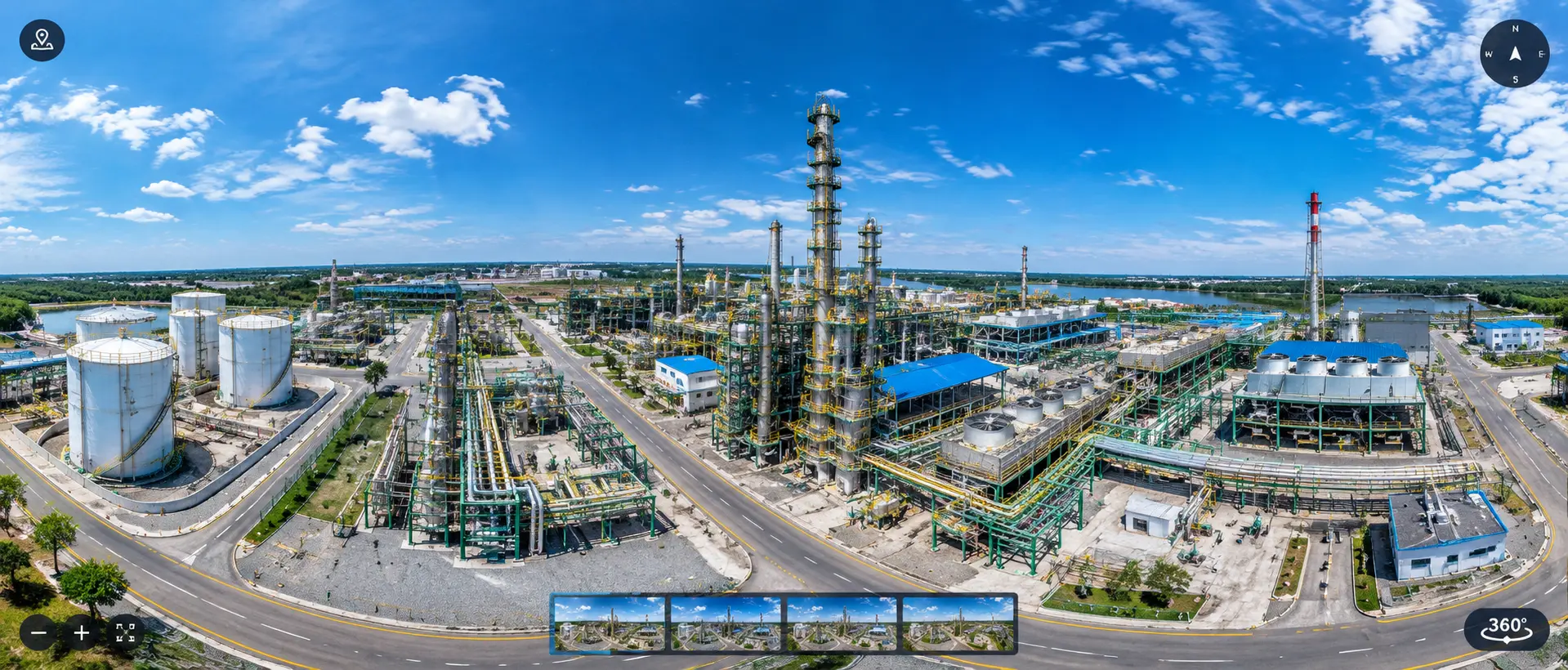
360° Site Documentation Through Panoramic Imaging
At Falcon Survey, we provide high-resolution panoramic imaging services to capture detailed 360° views of buildings, industrial facilities, construction sites, infrastructure, and other environments.
What Are Panoramic Images?
Panoramic images are wide-angle or 360° images that capture a large field of view from a single location. They provide a more complete representation of a space than conventional photographs.
When combined with 3D laser scanning and survey data, panoramic imagery can provide both visual context and detailed spatial information.
Applications of Panoramic Imaging
Building Documentation
Capture detailed interiors, rooms, corridors, facades, and other areas of existing buildings.
Industrial Facilities
Document equipment areas, piping, structures, machinery, and complex plant environments.
Construction Progress
Create visual records of construction conditions at different stages of a project.
As-Built Documentation
Provide a visual reference of completed buildings, facilities, and installations.
Infrastructure
Capture detailed panoramic views of roads, bridges, tunnels, stations, and other infrastructure.
Heritage Documentation
Create detailed visual records of historic buildings, monuments, and architectural features.
Virtual Site Review
Allow project teams to remotely review site conditions and revisit captured locations.
Panoramic Imaging for Remote Site Documentation
Panoramic images allow teams to revisit captured site conditions digitally. They can be particularly useful for large buildings, industrial plants, construction projects, and complex facilities where frequent physical site visits may be difficult.
Project teams can use panoramic imagery to review areas, understand site conditions, and support planning and documentation activities.
At Falcon Survey, our panoramic imaging services provide a detailed visual record of real-world environments. Combined with 3D laser scanning and point cloud data, panoramic imagery helps project teams better understand, document, and remotely review existing conditions.
Industrial Applications
Volume Calculations
Infrastructure Applications
Architecture Applications
Archaeological/Heritage
Registered Point Cloud
3D CAD Models
3D Mesh Models
BIM Models
Plant Design Models
2D CAD Documentation
Orthophotos
3D Virtual Reality
Panoramic Images
Leica TruView
Reverse Engineering
2D/3D Floor Plan
Sectional Drawings
Facade/Elevation Building Survey
Measured Building Surveys
Concrete Scanning(Post Tension)
Stockpile Survey

Contact Info
- 209, 2nd Floor, Apricot Tower P.O. Box : 238544, Dubai Silicon Oasis Dubai - United Arab Emirates
- info@falconsurveyme.com
- +971 4 327 1414
- +971 4 327 1413
- Monday - Saturday: 08.00 AM to 06.00 PM | Sunday is Closed
Social Links