

Any Questions? Let’s talk
+971 4 3271414
Related Services
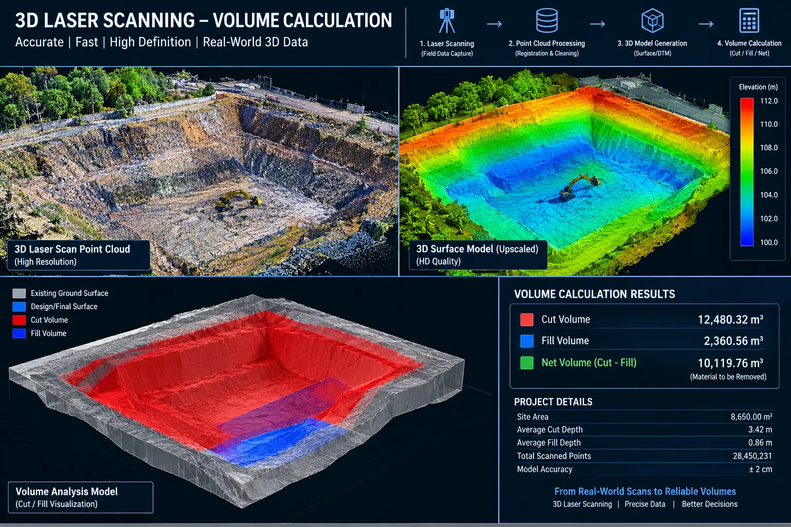
Volume Calculation Using 3D Laser Scanning Survey
Accurate 3D Volume Measurement From Real-World Data
Traditional volume measurement methods can require extensive field measurements and may provide limited coverage of complex or inaccessible areas. 3D laser scanning captures millions of points across the surveyed area, creating a dense point cloud that represents the actual surface conditions.
Our survey data can be processed to generate:
- Existing ground surface models
- Digital terrain models (DTM)
- Digital elevation models (DEM)
- 3D point clouds
- Contour maps
- Surface-to-surface comparisons
- Cut and fill maps
- Stockpile volume models
- Excavation volume calculations
These datasets provide a detailed representation of the surveyed site and support accurate volume analysis and project documentation.
3D Laser Scanning Volume Calculation Works
High-Resolution 3D Laser Scanning
Our survey team captures the existing site using terrestrial laser scanners or other suitable 3D scanning technologies. Millions of measurement points are collected to accurately represent terrain, structures, stockpiles, excavations, and other surface features.
2. Point Cloud Registration and Processing
Individual scans are registered into a unified point cloud using survey control and reference points. The data is then cleaned and classified to remove unwanted objects and improve the quality of the surface model.
3. 3D Surface Model Generation
The processed point cloud is converted into a triangulated surface, digital terrain model, or other suitable 3D representation. This provides a detailed digital representation of the actual surveyed surface.
4. Volume Calculation
The generated surface can be compared with a reference surface, design surface, previous survey, or defined boundary. The difference between surfaces is used to calculate:
- Cut volume
- Fill volume
- Net volume
- Stockpile volume
- Excavation volume
- Material quantities
5. Reporting and Visualization
The final results can be delivered through detailed volume reports, 3D models, color-coded maps, cross-sections, and other survey documentation depending on project requirements.
Cut and Fill Volume Calculation
3D laser scanning is particularly useful for monitoring earthwork and construction activities. By comparing an existing ground surface with a proposed or completed design surface, we can determine the quantity of material that needs to be excavated or placed.
Excavation Volume Calculation
For construction sites, foundations, basements, road projects, utility works, and other earthwork operations, laser scanning can provide accurate measurements of excavated areas.
By comparing the scanned excavation with the original ground surface or design model, we can calculate the amount of material removed and monitor changes throughout the project.
Why Use 3D Laser Scanning for Volume Calculation?
High-Density Data
Laser scanning captures millions of points, providing detailed information across the entire surveyed surface.
Detailed 3D Visualization
The resulting point cloud and surface model provide a clear visual representation of the actual site conditions.
Efficient Quantity Verification
Survey data can be processed and compared against design or previous survey surfaces to calculate material quantities.
Repeatable Measurements
Regular scans can be performed to monitor changes and compare volumes throughout the project lifecycle.
Improved Project Documentation
3D survey data can support quantity reports, construction records, engineering analysis, and project documentation.
Industrial Applications
Volume Calculations
Infrastructure Applications
Architecture Applications
Archaeological/Heritage
Registered Point Cloud
3D CAD Models
3D Mesh Models
BIM Models
Plant Design Models
2D CAD Documentation
Orthophotos
3D Virtual Reality
Panoramic Images
Leica TruView
Reverse Engineering
2D/3D Floor Plan
Sectional Drawings
Facade/Elevation Building Survey
Measured Building Surveys
Concrete Scanning(Post Tension)
Stockpile Survey

Contact Info
- 209, 2nd Floor, Apricot Tower P.O. Box : 238544, Dubai Silicon Oasis Dubai - United Arab Emirates
- info@falconsurveyme.com
- +971 4 327 1414
- +971 4 327 1413
- Monday - Saturday: 08.00 AM to 06.00 PM | Sunday is Closed
Social Links