

Any Questions? Let’s talk
+971 4 3271414
Related Services
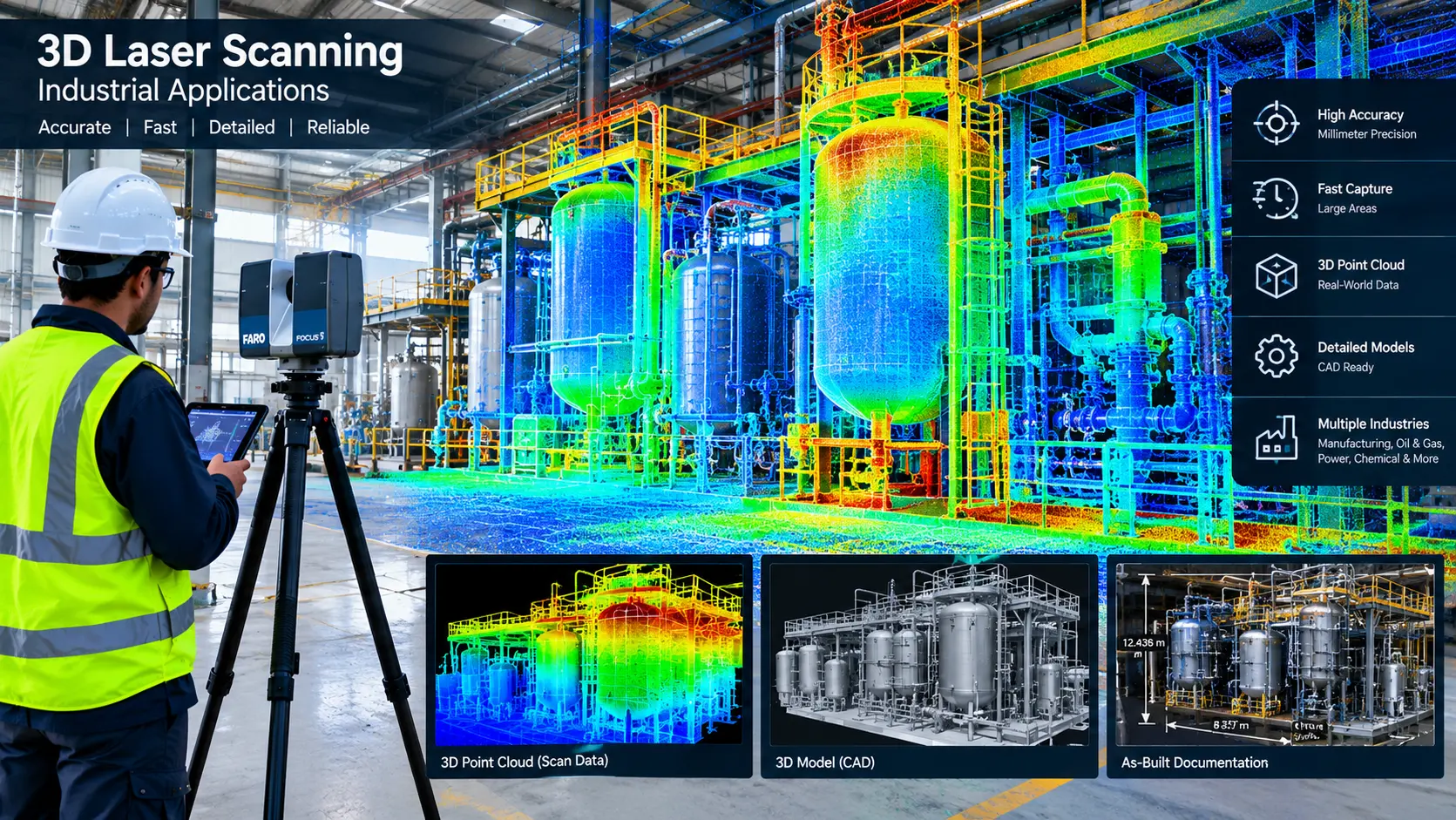
Industrial Applications of 3D Laser Scanning
One of the best methods for obtaining precise as-built data for buildings, machinery, infrastructure, and complex assets is industrial laser scanning. Millions of data can be gathered in a matter of minutes using high-precision laser scanners, producing an extremely comprehensive digital depiction of the surroundings.
Laser scanning offers a degree of precision and detail for engineering projects, maintenance scheduling, and asset management that is challenging to obtain with conventional survey techniques alone.
Industrial Laser Scanning: What Is It?
Industrial laser scanning measures current circumstances and generates a three-dimensional point cloud using specialized survey equipment. Engineers and designers may operate from an accurate digital depiction of the asset since each point in the cloud reflects a precisely determined location in space.
The data that is produced can be applied to:
- Scan-to-CAD projects
- As-built questionnaires
- Modifications to plants
- Identification of clashes
- BIM modeling
Design of engineering - Management of assets
- Verification of construction
Industrial 3D Laser Scanning Process
1. Site Assessment and Survey Planning
We review the project requirements, site conditions, scanning areas, required accuracy, and intended deliverables before beginning field data collection.
A suitable scanning strategy is developed to ensure adequate coverage and reliable registration of the collected data.
2. 3D Laser Scanning
High-resolution laser scanners are positioned throughout the facility to capture the surrounding environment. Each scan records millions of points representing surfaces, structures, equipment, and other visible features.
Strategically positioned scans help minimize shadow areas and provide comprehensive coverage of complex industrial spaces.
3. Registration and Point Cloud Processing
Individual scans are registered into a unified coordinate system and processed to create a clean, accurate point cloud.
Survey control can be incorporated where required to connect the scanning data to the project’s established coordinate system.
4. 3D Model and Drawing Generation
The processed point cloud can be used to develop the required engineering and survey deliverables, including:
- 3D models
- Floor plans
- Sections
- Pipe routing information
- Equipment layouts
- Structure drawing
- As-built documentation
- Point cloud datasets
5. Quality Control and Delivery
The final data is reviewed for completeness and consistency before delivery. Outputs are prepared according to project requirements and can be supplied in commonly used formats for engineering, BIM, CAD, and visualization workflows.
Industrial Applications
Volume Calculations
Infrastructure Applications
Architecture Applications
Archaeological/Heritage
Registered Point Cloud
3D CAD Models
3D Mesh Models
BIM Models
Plant Design Models
2D CAD Documentation
Orthophotos
3D Virtual Reality
Panoramic Images
Leica TruView
Reverse Engineering
2D/3D Floor Plan
Sectional Drawings
Facade/Elevation Building Survey
Measured Building Surveys
Concrete Scanning(Post Tension)
Stockpile Survey

Contact Info
- 209, 2nd Floor, Apricot Tower P.O. Box : 238544, Dubai Silicon Oasis Dubai - United Arab Emirates
- info@falconsurveyme.com
- +971 4 327 1414
- +971 4 327 1413
- Monday - Saturday: 08.00 AM to 06.00 PM | Sunday is Closed
Social Links