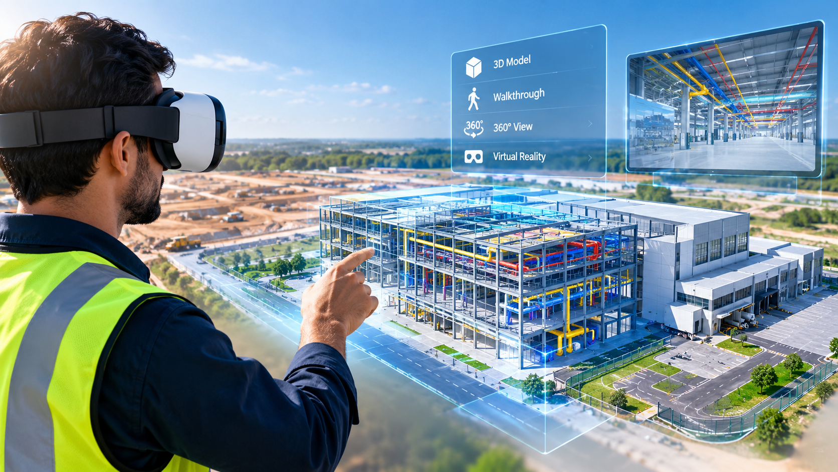
3D Virtual Reality

Falcon Survey Engineering Consultants
3D Virtual Reality
FALCON SURVEY

Step Inside Your Project with 3D Virtual Reality

At Falcon Survey, we create 3D virtual reality experiences from laser scanning, panoramic imagery, 3D models, and spatial data. Our solutions allow users to explore buildings, industrial facilities, construction sites, infrastructure, and other environments digitally.

The creation of Virtual Reality (VR) and Augmented Reality (AR) experiences is being revolutionized by 3D scanning. 3D scanning makes XR content more immersive, interactive, and scalable by transforming real-world objects and surroundings into precise digital models.

The most realistic virtual and augmented reality experiences are those that mimic the actual environment. When environments feel manufactured, scale seems off, or items lack authenticity, users may tell right away.

It takes a lot of effort and money to create lifelike digital objects from scratch. The intricacy, texture, and proportions of real-world objects and environments are frequently difficult for manual 3D modeling to replicate.

This gap is filled by 3D scanning, which creates accurate digital replicas of real-world items and environments.

Scanned data enhances realism, speeds up content generation, and permits more natural interaction when incorporated into VR and AR, increasing the plausibility and efficacy of immersive experiences.

Immersive 3D Site Visualization

Our 3D virtual reality solutions can transform surveyed environments into interactive digital experiences. Users can navigate through spaces, view details, and understand the relationship between different areas and elements.

These solutions are useful for:

Applications of 3D Virtual Reality

Architecture & Design

Explore building interiors and designs in an immersive 3D environment before or during a project.

Construction

Review construction progress and existing site conditions without being physically present at the location.

Industrial Facilities

Virtually navigate plants, equipment areas, pipe racks, and other complex industrial environments.

Training & Safety

Use realistic digital environments to support training, familiarization, and safety planning.

Heritage & Preservation

Create immersive digital experiences of historic buildings, monuments, and heritage sites.

Facility Management

Provide teams with a visual digital reference for buildings and facilities.

Remote Site Review

Allow project teams, consultants, and clients to remotely explore surveyed environments.


Industrial Applications

The petrochemical industry has been using 3D laser scanning for years, but more and more also other industrial sectors see the usefulness of this technique for the management of industrial plants

Volume Calculations

For the determination of the volumetric of stocks 3D laser scanning is used as a reliable and safer alternative to conventional surveying when accuracy is needed.

Infrastructure Applications

Complex structures in field of civil engineering such as bridges and tunnels are measured with a lot of detail with 3D laser scanning.

Architecture Applications

By scanning the facades and interiors of a monumental building a 3D point cloud of the entire building is created. This data serves as the basis for creating floor plans, facade plans, etc.

Archaeological/Heritage

Registration of geometric information of monuments, statues, archaeological remains, etc. makes a major contribution to the preservation of heritage.

Registered Point Cloud

For Clients That Wish to Complete Their Own Post Production We Can Scan and Supply a Registered Point Cloud

3D CAD Models

For Clients That Wish to Complete Their Own Post Production We Can Scan and Supply a Registered Point Cloud

3D Mesh Models

3D mesh models are ideal solution for irregular or organically shaped objects

BIM Models

We can convert the point cloud into a BIM ready format, REVIT, AECOSIM and ARCHCAD models

Plant Design Models

We offer conversion of point clouds into AVEVA PDMS, CADWORX and open plant models

2D CAD Documentation

Highly accurate floor plans, sections & elevations can be generated in a variety of formats and levels of detail which can suit your specific requirements

Orthophotos

We offer Orthophotos – Metric Images Commonly Specified for Heritage Sites

3D Virtual Reality

We can professionally specified the objects, buildings spaces and create game-like environments with interactive 3d walkthroughs.

Panoramic Images

Panoramic images can be supplied referenced to a site map allowing the user to navigate around the site in a product called panotours

Leica TruView

TruView combines panoramic images with point cloud data, allowing the user to take measurements, mark up and share views. It provides an effective visual decision-making tool

Reverse Engineering

Reverse Engineering services help you accurately capture, analyze, and recreate existing components, equipment, structures, and products.

2D/3D Floor Plan

We create accurate and detailed 2D and 3D floor plans that help architects, engineers, contractors, property owners, and real estate professionals understand spaces clearly

Sectional Drawings

We create accurate and detailed sectional drawings that provide a clear view of building elements, levels, heights, materials, and construction details.

Facade/Elevation Building Survey

Our Facade & Elevation Building Survey services provide accurate documentation of a building’s external appearance, dimensions, architectural features.

Measured Building Surveys

Our Measured Building Survey services provide precise measurements and detailed documentation of existing buildings and spaces. We capture the actual dimensions,.

Concrete Scanning(Post Tension)

Post-tensioned concrete structures contain high-strength steel tendons embedded within the slab. Drilling, coring, cutting, or anchoring without knowing their exact location.

Stockpile Survey

Stockpile surveying provides accurate measurements of material volume, quantity, and distribution for aggregates, sand, gravel, soil, minerals, and other bulk materials.
FALCON SURVEY ENGINEERING CONSULTANTS is a pioneering Survey Engineering Company in U.A.E. established in the year of 2007, Falcon Survey Engineering built on a strong work ethic, honesty and a commitment to relationships.

Contact Info

Social Links